Musings from Ian Pope on the second of his three crossing of Bass Strait – Victoria to Tasmania
I know that voice
Ian Pope
It was 4 am on a Sunday morning and I could hardly hear the alarm for the beating of the rain on our little cottages’ roof. The wind howled through the trees outside as I clobbered the alarm and fell back into a half sleep.
The last couple of weeks had been poor weather with weak cold fronts constantly passing through South Australia bringing drizzly cool days, and today was no exception with showers expected for most of the day.
I realised that Gavin and Michael would be here soon and contemplated just a few more minutes in bed. I thought they know that I am always late, but then Gavin is always early so I slowly dragged myself from the warm bed.
The mountain of gear stacked neatly in the hallway needed only the last minute additions of fully charged camera batteries and such like, which I dutifully attended to, crossing off each item off my list. All ready to go, just as I heard Gavin’s car pull up out the front. Gavin bowled in, looking just like someone who is always awake before five, which of course he is, followed by Michael who hasn’t seen this time of darkness since our last trip.
The gear was loaded and I found that Michael has claimed the backseat for the trip and I had the duty of riding in the front with Gavin, ensuring that he was awake during the drive. How anyone can stay awake listening to ABC Radio at that time of the morning is beyond me, but duty called.
Sombre music, then marching bands: hell what was this stuff he was listening to? We passed along the foggy highway out of Adelaide to the tunes of the 127 th District marching band or some such mob, thinking that I wouldn’t be able to take eight hours of this.
Passing through Tailem Bend I realised what was happening. It was Anzac Day.
There was a group of 200 or so people gathered at the park, with many spilling onto the roadway, forcing us to crawl past. I remembered back to my only time of being at an Anzac Day dawn service, when I must have been about 10 years old. I vividly remember the service being held in a local park in Parkside where I grew up, but can’t remember who I went with, or what happened afterwards. Just the short service and the music.
Sunday morning on ABC radio is Macca in the morning. I listened to the introductions and then vagued out while staring at the unchanging landscape of the mallee country. Macca had people ringing in to recount their views and memories of Anzac day.
As I rolled along in the front seat, listening to Michael’s snoring in the back I heard a woman’s voice saying that she had just come from a dawn service held with her husband and only one other person. It was a Tasmanian accent, quite distinctive but pleasant to listen to. Sounded in her late 40s or thereabouts, well spoken and confident. I didn’t hear where she was from, assumed Tasmania, but she was talking about their dawn service held on the top of a hill at the site where four RAAF flyers had died in a crash near the end of the war. They had been on a training run or similar and had engine problems resulting in the crash. The bodies had been buried elsewhere but there was still the scattered remains of plane where a small memorial was erected. She spoke of the isolated area that they from, describing the wallabies on the hill and sea views from her kitchen window. Sounded like a great place to me…
Then off we headed. Victoria to Tasmania by sea kayak.
Gavin, Michael and I stood at the base of the cliff, on the tiny windswept beach, looking up at the zig zag track that leads to the lighthouse keeper’s cottage. We had had a long hard day, crossing from Hogan Island to Deal Island, with lightning greeting us just before our dawn departure. The wind was OK before dawn but talking by phone to the duty forecaster in Tasmania I knew that we had only a few hours to get off the island or be there for some time.
The winds had risen later in the morning as we sailed and paddled our way to Deal Island in the Kent Group. Rising wind and rising seas had made for a rough ride, with worse on the way. We paddled strongly knowing that the sanctuary was only a couple of hours away, however the front grew closer with steadily increasing force. Rising seas and wind from the rear quarter made for interesting times. We eventually made shelter in the lee of Erith Island with a 40kn headwind screaming towards us as the main front hit.
The paddle along the Murray Passage was demanding with the wind coming head on between the Islands, as Michael powered past us determined to land first. Maybe he was just glad to be near a safe haven after having suffered two capsizes whilst sailing that morning, or maybe the lure of a cup of tea and Mars bars had scrambled his brain. He is a legend in the world of chocolate bars, carrying large packets of Mars Bars and the like when we go paddling. Still, you can’t complain when he insists on sharing them out after paddling, but I still think that anyone who calls them carrots is still a little unusual.
We set off fully equipped for the climb up the Deal Island path with extra supplies of Mars Bars and Snickers stuffed in our pockets. Half way up the path we paused briefly to admire the view and call in to our families. The surprise of the caretaker was evident when we strolled up to the cottage, certainly not expecting paddlers in this weather, but as always we were invited in for tea and scones.
It was unsafe to proceed to the campsite and hut on Erith Island so we were able to bed down in the spare cottage on Deal. We had the opportunity of a hot shower and a real bed and that was not to be knocked back. A quick shower and change of clothes and up to the caretaker’s for high tea.
We entered the cosy warm cottage and met our hosts Dallas and Shirley. They are caretakers on the island for three months at a time, with this being their second time here.
Bloody hell, I know that voice!, the soft but distinct accent coming from the kitchen sounded familiar, but I didn’t recognise the face. Shirley plied us with scones with jam and cream and tea, while I thought about where I knew her from.
When talking to Dallas about the awful weather heading our way it came to me. Have you been on the radio lately? “Yes, twice on the ABC talking about Deal Island”. Did you have an Anzac dawn service here? “Yes just three of us, up near where the plane crash site”. It was her, the voice on the radio that cold rainy Anzac morning. Strange things seem to happen when you go paddling.
We were marooned on Deal Island for eight days waiting for the weather to moderate. The winds stayed at around 60 kn for most of that time with huge seas battering the island group. We did wallaby musters, helped other blow-ins and had many other adventures in those eight days and many more on that 19 day crossing of Bass Strait, but maybe I’ll write them down later.

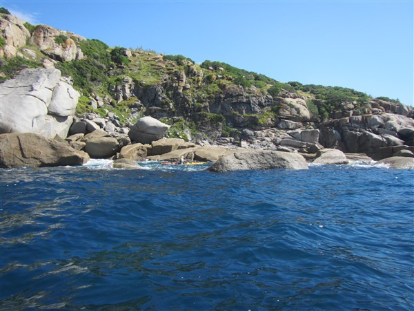
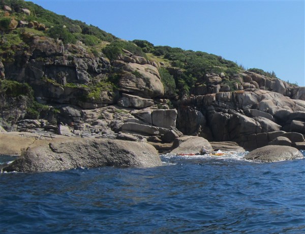
Deal Island looking towards Erith and Dover Islands

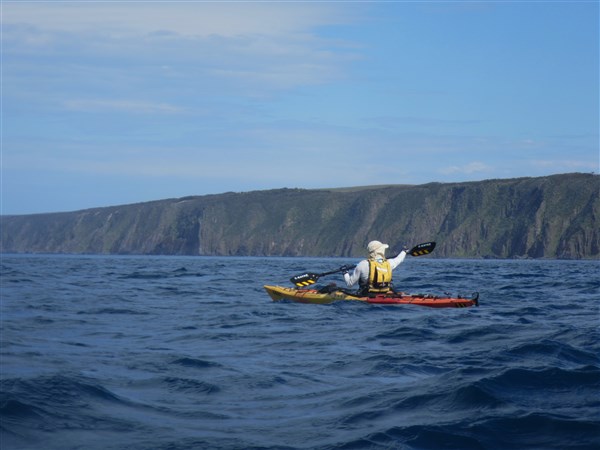
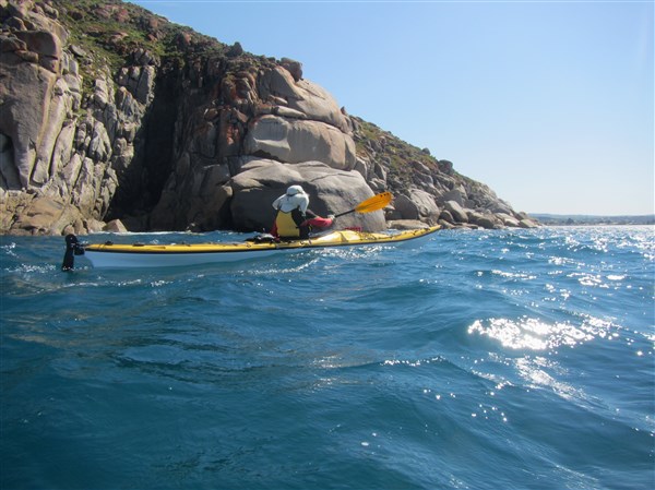
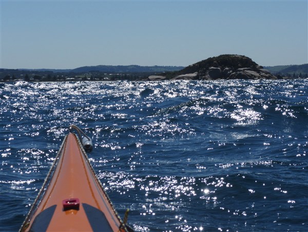
Michael paddling and sailing in calm conditions
Mal Blewett . Solo crossing Victoria to Tasmania Bass Strait
Taken from his log and in reverse order. Scroll down for the start.
A solo paddle from Wilson’s Prom, Victoria to Little Mussleroe Bay, Tasmania. Single kayak – model Nimbus Telkwa kevlar

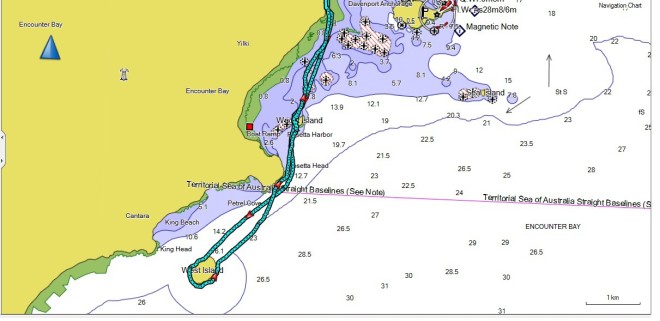
Mals planned route
It took 13 days to paddle there, but longer to get back. Mal cant get back on the Spirit of Tasmania Ferry until early April.
Mal B reports from Tasmania
Hi All, well that’s it; the big crossing is done. Arrived on Tasmania’s shore today around 4.30pm(EST), to be greeted by my wife Annie, Mal Hamilton & his daughter Donna. The crossing of Banks Strait from Rebecca Cove on Clarke Island to Little Mussleroe Bay on Tassie, went well with the strong currents and 4mtr swell muddled in with a 2mtr constant wind wave and 20knots of wind, just to keep me on my toes. My little make shift compass spent most of the day pointing in the wrong direction as it has done since having my good Silva compass smashed at the beginning of the expedition. I shall be writing a very stern letter of complaint to Garmin since my good GPS the Garmin 78sc decided to die completely as I was about a mile out to sea on the start of the long ocean crossings many days ago. No compass and a stuffed GPS makes for a lot of guess work. I did carry my spare Garmin 78s which constantly shuts down. Oh what fun!!!
Many thanks to all that have given me help and assistance along the way. I will create a list and add it to this web posting when I get settled back to civilization.
Today Bass Strait tomorrow the world!!!!

3.59 pm today. Recd SPOT message – landed at -40.76202,148.03653 Yes thats TASMANIA. Will post a report when he checks in (when he finds a place with phone reception)
20/3/12 8.33am He’s on the last leg – one more open sea crosssing to go.
Hi All,
Today I’m leaving for the last paddle of the expedition. The infamous Banks Strait. This area is known for rough waters and a 3 Knot current. Today seas are moderate around the 2mtr mark and there is a 20Knot NNE’ly wind blowing. Which for a change is not coming direct at me. Spent the night at the beautiful Rebecca Cove and a zillion mossies, but thankfully no Rats!!!. This area is strewn with fantastic offshore “rock gardens”, you could spend days here just playing in and around the rocks with your kayak. Next landing hopefully Little Musselroe Bay on the NE corner of Tasmania.
To all those that have sent comments many thanks I will reply and fill in the missing info. I found as the days went by, many times I was either landing late or did not have phone reception making keeping up to date difficult….. Mal B

Rebecca Cove. My last campsite before crossing the Banks Strait to the Mainland
19/3/12 4.17pm Mal changed his mind !!!! he has gone way past Preservation Island. I got his Spot alert and he is past Spike Cove . (paste his location into Google earth -40.56523,148.13565 to see his campsite). Havent had any other report from him so far. He could be on the Tasmanian mainland this time tomorrow if the weather holds out….. Ian
19/3/12 Mal left for Preservation Island at dawn this morning. He will then try to cross to Tasmania Tuesday early morning. This will be his only chance to catch a weather window and suitable tides to cross Banks Strait which can be a very nasty crossing. Miss this chance and wait a week for weather to pass on a small windswept island !!!!

18/3/12 9.04pm Mal Reports... Having problems with reception so not sure of reports next couple of days,will send SPOT signal. Now at Trouser Point. Bugger of a day with 15-20kn headwinds all day. Off to Preservation Island early in the morning. Weather going to turn to crap. Plan to do run to Little Musselroe Bay Tasmanian mainland on Tuesday, otherwise weather and tides are bad and will be trapped here for some time….. Mal B
18/3/12 Mal has moved in the direction of Trouser Point. Expect report tomorrow
17/3/12 Camped at Settlement Point. Mal has moved down the coast of Flinders Island to Settlement Point. A beautiful beach and campsite. Phone reception is not good but expect an update in the next day or two.. His location is -40.00241 , 147.88867. Yep, he’s in the Roaring 40’s, that latitude that has bought many a savage storm and many an adventurer unstuck.
16/3/12 Mal is on Flinders Island. Sheltering from bad weather in the area and hopes to move south along the island over the next couple of days.
15/3/12 Mal reports in from Flinders Island.
Hi All,
Landed at Killiecrankie at 6pm last night (Wed 14th March) which is a small settlement on the Northern tip of Flinders Island. The days paddle was around 70kms and around 11.5 hrs paddling and it just dragged on. The famous words of Bart & Lisa Simpson “Are we there yet” kept coming into mind. The sea state was quite good for the first 10kms with the usual 3 Mtr swells looming at you as a big powerful wall of water. The rest of the trip was made up of coping with the strong currents and constant head winds which just added to the drag. Saw many Penguins swimming as I paddled up and down the swells. I was met on the beach by my wife Annie and good friend Mal Hamilton and his daughter Donna who flew out to Flinders Island.
Forgot to mention that during the paddle from Refuge Cove to Hogan Island, I had many sea birds circling around me during the day, including many Albatross with their 2mtr wing tips just missing the water, a beautiful site. The funniest thing so far on the expedition was one of these Albatross (which I think was a Southern Royal)
came directly at me from about 10mts away I watched as its wings start to flutter then these two big webbed feet dropped down from the undercarriage as air breaks as it was ready to land, the words “bugger off” were screamed out. The thought of a big bird sitting as a hood ornament on the front of my kayak as I went up and down the swells just didn’t seem right. The things you see when the camera is not out. Paddled the next k or two laughing my head off.
The weather is looking like it might be turning bad so not sure what will pan out over the next few days
Mal

Landed at Flinders Island
6.15 pm EST- Mal has landed on Flinders Island
His position is -39.83583, 147.83611 Paste this into Google Earth to see where he is. More info when I get his report……Ian
14/3/12 6am Signal recieved – Mal has left Deal Island for 70km+ crossing to Flinders Island
12/3/12 5pm Mal is doing his washing on Deal Island
Mal B reports from the Kent Group of Islands a cluster of three islands, Erith, Dover & Deal.
Day off the water for a change. Spent the day washing, drying, ironing (nah not quite) at my campsite on Winter Cove on the Eastern Side of Deal island. Lovely spot to paddle too one day if your keen!!! Yesterday I had reasonable good sea state, the swell was still up and did I mention the strong currents. We have just come out of a full moon cycle which intensifies the currents. My intended path yesterday went to pieces within about 10kms of Dover island. The plan was to reach the Southern tip of Dover and enter the notorious Murray Passage renowned for it’s strong currents. I got swept further South than intended and had to fight the current to get back. My plan rapidly changed about 1km from Dover where the current speed by my GPS of 6 Kms/hr or 3.2 Knots was nearly matching my paddling speed. Extra grunt got me to the cliff line where the current speed reduces. The best option was to now follow the Islands West side and aim for the shallow gap between Erith and Dover Islands. By the time I got to gap the tide was now at high tide and slack. I then popped into West Cove and East Cove for a look and photographs then used the Ebbing tide to help get me around to Winter Cove. Last night I was visited by a rather large beedy eyed Possum who nearly came into the tent. Tomorrow off to Flinders Island which is the longest open water crossing of the trip considering the current drift off track it will be around 70kms.
To all that have left messages thank you heaps, I will reply when can. Phone reception at the moment is unreliable.
Mal
Mals early morning report from Hogan Island.
Good night on Hogan island, kept awake by penguins chirping and rats running around. Setup tent on the foreshore and walked away to sit on the rocks nearby to cook tea. Classic beef curry dehydrated yum!
Looking at tent and kayak the occasional rat crawls past to inspect. Woke this
morning, heading to Deal island today 50 kms away. Big halo ring around the moon, rains and storms on there way!!! Left the packet in the photo out by mistake last night, rats are masters of deciet opened at the bottom to avoid detection. Just noticed as I was packing my kayak about a meter away a rat was inside the front kayak hatch and helping itself to a free meal of muslie bar. Till day break I had them at my feet, cost me a lot of wasted time shooing them off. What a place! (we are waiting for the photo…. Ian)

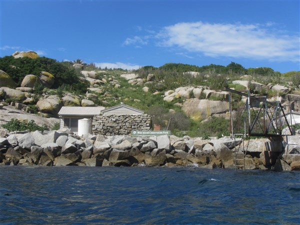
The house at Winter Cove
11/3/12… Arrived at Hogan Island today. Nine hours paddling started off calm seas but about a third of the way it started to be normal 2mtr swell and an opposing wind wave. Then progressed into rough seas and strong currents from about 10kms away from the island. Lovely little isolated island There is a hut to stay in if I wish to share it with the local rats. Has anybody seen Wilson??? Mal B

View of Hogan Island Hilton looking towards Tasmania
11/3/12 2.50pm Mal landed on Hogan Island. More info later. Try this location in Google earth to see his current location. -39.21298, 146.99167 ….Ian
11/3/12 5.23am Message recd from Mal. Leaving Refuge Cove – heading into Bass Strait today.
(Weather appears much better this morning. Should be a better day on the water. –Ian)
10/3/12 8.50am. Repair work done. Mal has repaired the kayak overnight and will be pushing on to Refuge Cove this afternoon. There he just waits for good weather before pushing off into Bass Strait and then Tasmania. Photos show how quick the weather calmed this morning. 3.45pm Mal has arrived safely at Refuge Cove.

Waves crashing in to the bay – look small from this angle

Waves have calmed in just a few hours

Small bushwalking compass installed on the base of old one.

- Bending the rudder back into shape using what was available
9/3/12 3.50pm Things not so good.
Things are not good. Slammed by 4m-5m waves. Dumped by a 4m + wave around lighthouse point. Rolled back up again to be slammed by a few more. Compass smashed, rudder bent, shoulder hurt and I’m not so good, but made it to shore. Apart from that every thing is dandy. Thanks for all the best wishes from everyone, and remaining positive . Wish you were all here !!!!
9/3/12. Mal is on the move down the coast, but the weather is still bad.
5.27am this morning his SPOT message said he was on Biddies Cove Beach. Latest message 8.19am – all Ok at -38.89127,146.48186 . Thats about halfway down the coast to Refuge Cove, his stepping off point into Bass Strait. If you cut and paste
-38.89127,146.48186 into Google Earth you can check out his location….
Weather looks like easing a little tomorrow.Pity he hasnt got Adelaides weather……Ian
8/3/12 Mal is still waiting for weather window. Very windy at present and wont paddle today.
7/3/12 He’s off and paddling, leaving this morning from Pt Welshpool Victoria.Malcolm B had strong head winds this morning with gusts up to 35kn (about 65km/hr) but decided to move out of the Port Welshpool area and he is now camped on the beach at Biddie Cove ready to make a run down the coast when the weather gets better. If you paste this location into Google Earth you will see him on the beach waving.-38.78162 , 146.46037
To keep you informed of his progress I will update this page every time that he paddles. So check in when you can and share his adventure.
2/3/12 He’s off and paddling … err…. or will be when the weather improves
Mal said—-Mid to late next week (if the weather decides to behave it’s self) I am going to be on the water at Port Welshpool, Victoria and leaving for the Bass Strait sea kayak crossing. The journey is a solo unsponsored / unsupported expedition and will cover around 350 kilometres and “should” take around 9 days or so. The weather at the moment down there is not favourable so some delays are to be expected.
Ben and Lach Victoria – Tasmania- circumnavigate and return
MISSION ACCOMPLISHED
Finally made back to vic. It’s been a great trip, 3 and a half months on the water. About two thirds of that spent sitting out some of the worst weather Tassie could throw at us. Highest recorded wind was 155km/hr, largest waves in excess of 10 metres. Good days to be bunkered down in our tents. Beautiful scenery the whole way and thanks Tasmania for having us.
19/3/12 The boys have reached the halfway point in their journey. Follow their link to the latest photo.
4/3/12 Adventure Expeditions – Wanderer:
Hi, we are ok & are remaining in this location. Our next check in ok message will indicate our intent to continue.
-42.6123 latitude, 145.28491 longitude
(Past Macquarie Harbour and heading for the South western Conservation area)
26/2/12 Had a great time lazin about in Strahan, time to get the show on the water again. We’re off to the heads at Hells Gate today and will wait for a weather window to run down the coast to Hibbs Point. From there it’s all go to Hobart with a stop in Bathurst harbour for a little upriver sojourn. There are plenty of safe landing sites along the coast if you look carefully enough and take heed of wind and swell direction. Check out the points on our map of the route for more details. We could be in Hobart in 10 days ish if the weather is good, or three weeks if it all goes to pot. We’re both really looking foreward to the next leg and the remoteness the southwest brings. We won’t have any reception from the heads in Strahan to Southport near Cockle Creek so there won’t be much contact other than the regular Spot updates each night. So follow our progress and well post the photos and details of the journey when we’re back in mobile range again. Lifes short, kayak naked!
A bit of a detour – Bass Strait style
30/1/12 Camped on Black Pyramid in the middle of BS. Why are we on an isolated rock in the middle of nowhere with a southern ocean gale raging… don’t ask!! Just know that the forced rock landing in 25kn was a little exciting to say the least. I managed to surf onto a platform and spent 15 minutes fighting the waves who were determined to have my boat and me back down the 1.5 meter drop to the death zone. Finally i Z pulleyed it up the rocks to safety. Lach tried to get in on the same spot and got sucked back down the 1.5 meter drop off twice before trying to get out. It almost worked, but his boat got sucked back down the drop before we could tether it and he had to dive back in and swim after his boat to retreive it. He swam with his boat to another landing site about 200 meters down the island and throw bagged a line to me and I Z pulleyed it up with the surges. Lach body surfed in with the seals, quite halarious. A testiment to good training and having the right kit at hand. The whole episode was terrifying and in no way graceful, but we are both safe and sound with no injuries. Will be here for a few days to repair the boats and make sure the cracks and holes are all sealed. It’s not good to see daylight through your hull right?? Initial toll is,1 hole and 1 split in my boat and 2 holes in Lachs. We lost a compass, a shoe, paddle float, sponge and all our dignity. Lucky the trusty glass kit is packed. Awesome island with a huge seal population and about a million birds. Great scenery and good coffee, happy daze. Pretty sure not too many people have the privelage to visit this spectacular spot! A little work to be done and some weather to pass and well be back on route to the mainland after this little detour. Oh yeah, and we still have to survive the launch from this rock, i have a feeling it is going to be as crazy as the landing, but hey fingers crossed all goes well. Catch ya all in a few days with an update on the repair progress. Happy paddling… Blue skies! Benno and Lach

16/1/12. 2 hours sleep, 15 hours paddling ahead… King Is here we come. Nothin like a night paddle in BS to kick things off with a bang!
100ks, 17.5 hours, off the couch… training’s just fit people showing off!!!

Paddling in darkness Bass Strait
To visit the latest adventures from Ben and Lach follow this link.


