Sea kayak Day Paddle – Seal Island Victor Harbor. Well not so much a day paddle, more like a morning sojourn which can be everything from calm to crazy. Today it was moving towards the crazy side.
It’s the Spring Equinox today and you would think we could rustle up a little spring weather for our Spring Equinox paddle but it was nowhere to be seen. It was another of those strange days you get at Victor Harbor in Spring, where it promises sunshine but delivers cold overcast skies. The forecast was for gentle 10kn SE’ly winds with clear skies but the reality was a 15-18kn SE’ly wind opposing a 2 metre SW swell, overcast skies and a temperature around 13C.
Not ideal conditions for this area today and even under ideal conditions you should have good “sea kayak skills” to paddle this area. However, two of us were standing on the beach with not much else to do except get cold and wet so off we went.
The plan was to paddle from Kent Reserve towards Granite Island, skirting an area of reefy breaks and bommies, then head out to Seal Island, returning via the eastern side of Granite Island.
We headed out getting some protection from Granite Island.
Although the seas soon became confused with wind against swell.

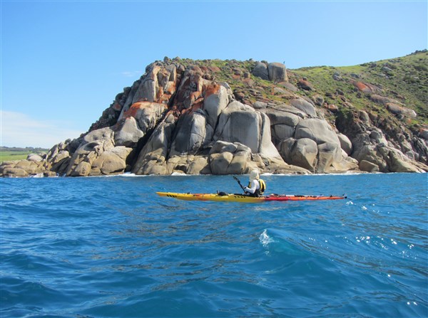
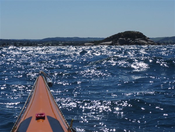
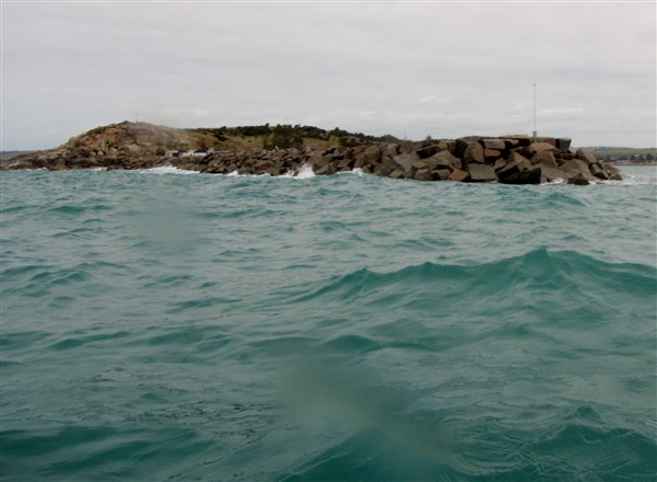
Seal Island in the distance
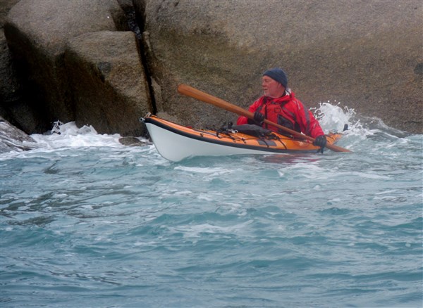
It then became impossible for me to take photos as I was tossed in the steep waves from the wind driven SE hitting the SW swell and also being thumped by occasional large clapatis waves from Granite Island. “BHOP time” (both hands on paddle)
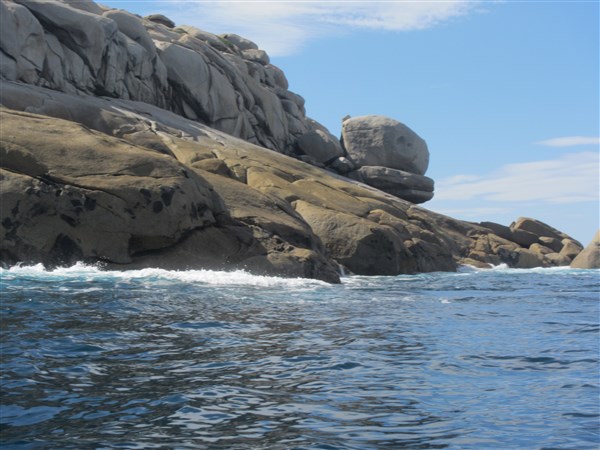
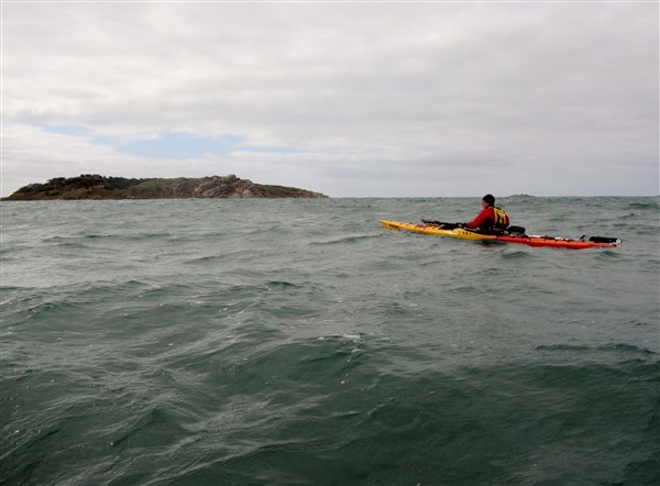
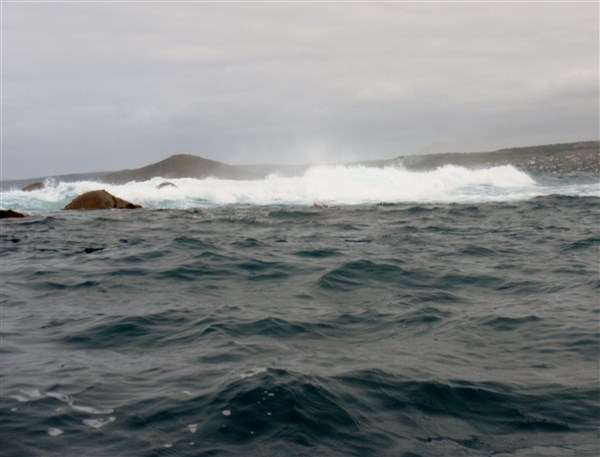
We worked our way out around the various reef breaks .Seal Island is protected by a number of reefy breaks and today all of them were savage.

Nearing Seal Island
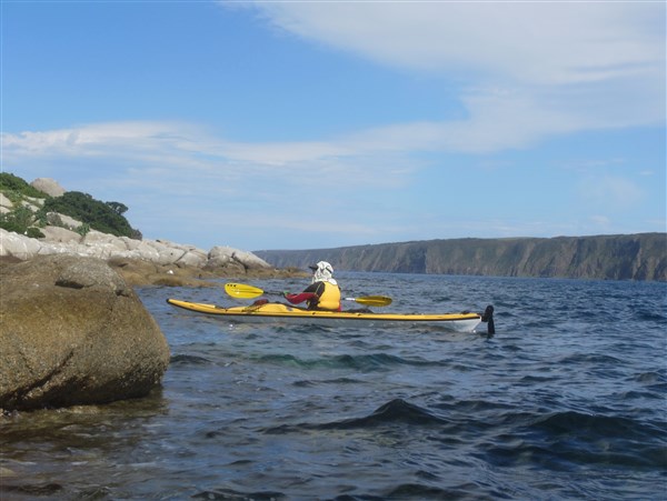
We reached a small protected area near Seal Island.
Reaching a calmer area
Even the seals decided it was too rough to come out and greet us.
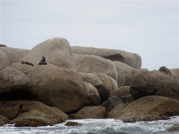
Too cold and wet even for the seals
Steve was a very happy boy to find a little sheltered spot.

A short respite from the wind
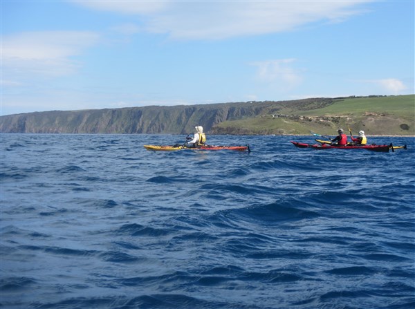
After our short visit with the seals we headed back towards the eastern side of Granite Island with a large lumpy following sea. Again photos were a little difficult to get.

Riding the crests
Once around the breakwater we were in calm water.
Rounding the breakwater

Calm waters
Then onward past the jetty.

The boat wharf.

Under the causeway
We watched the tourists on their way onto Granite Island aboard the horse drawn tram…..

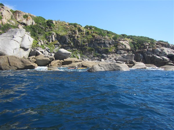
…and then spent some time playing amongst the rocks.

Protected waters. Encounter Bay township in the distance.
Getting up close and personal with granite boulders

Sliding on the swells
A great morning of paddling to celebrate the Spring Equinox. Now where’s my mountain bike ? I’m heading north to where it’s warmer. Ian…Paddling South.
Starting point. Kent Reserve Victor Harbor
Distance. 8.5km
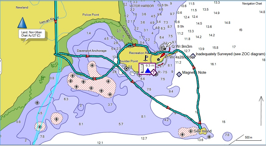
Seal Island Victor Harbor paddle
Hazards. A number of dangerous rocks are charted as well as reefy areas. Clapatis from Granite Island can make for a very confused sea in some places. Swell may break near Granite Island. Consult marine chart before attempting. Avoid paddling close to south side of Granite Island due to large swells breaking and dangerous currents.
Chart AUS 127


Paddlers and photographers
Ian Steve