Let’s take the BIG BOAT today

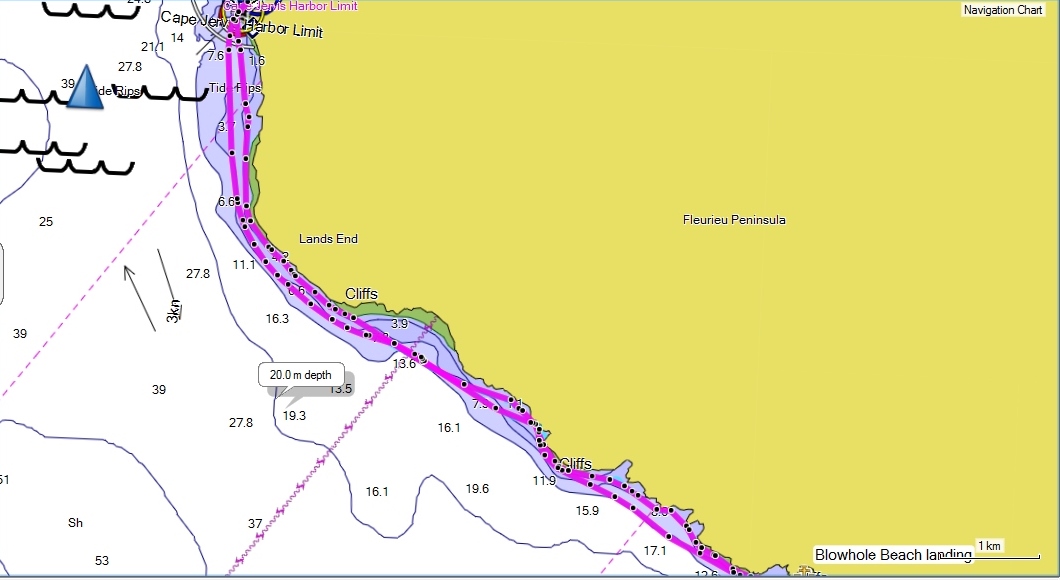
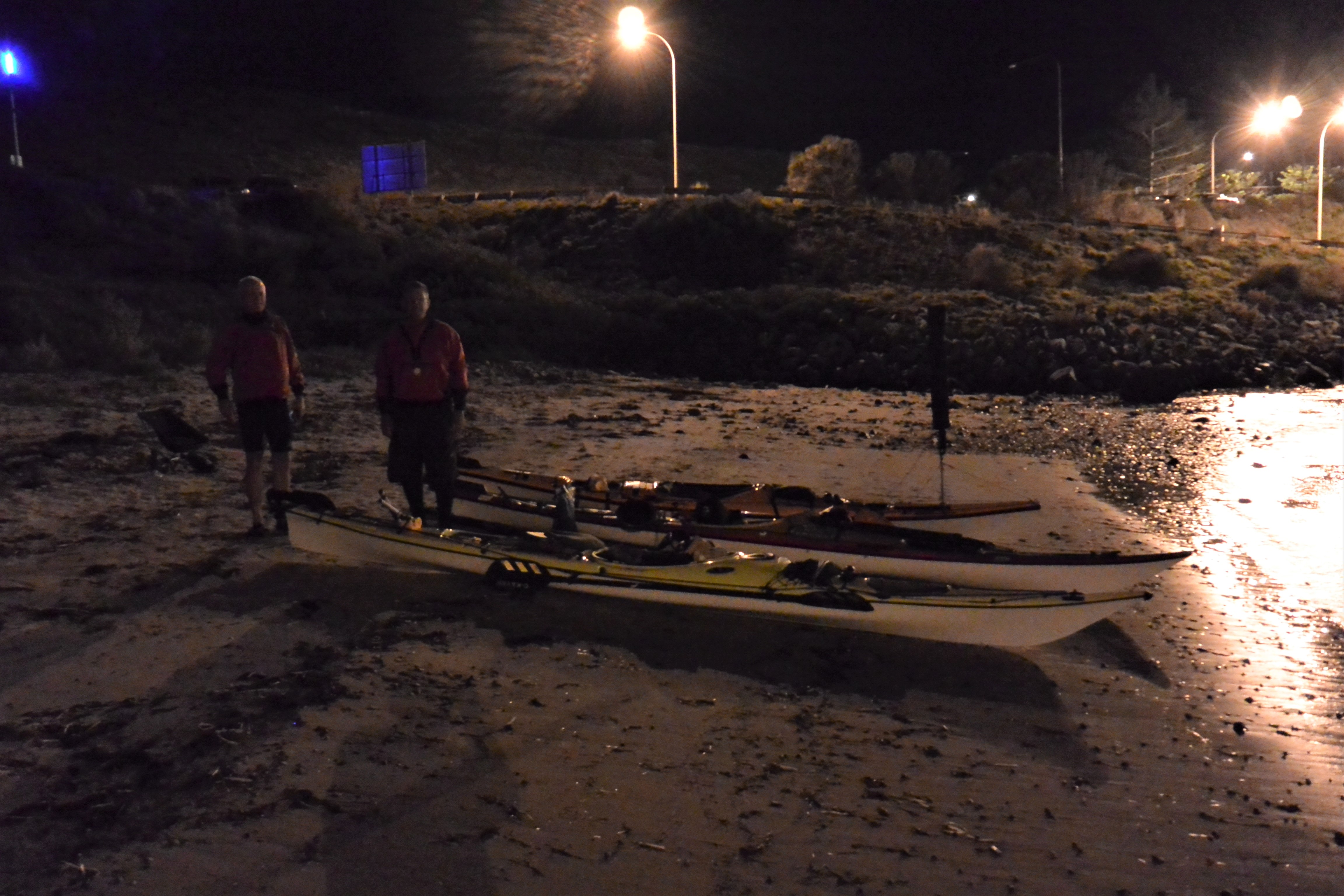
It was a calm Autumn night, although a little warmer than expected as I laid in my sleeping bag on the beach. The three of us were scattered around trying to get a few hours sleep before our pre-dawn departure. I shut off the phone alarm and checked the latest weather forecast which confirmed calm conditions for today and a light tailwind for tomorrow. Perfect conditions for Steve’s first 20 km open water crossing of Investigator Strait to Kangaroo Island.

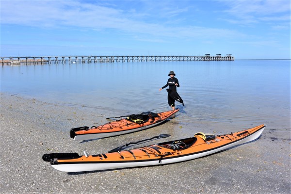
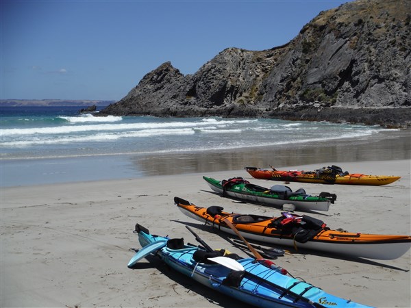
Michael, Steve and I stuffed our kayaks with gear and posed for a photo on the beach.

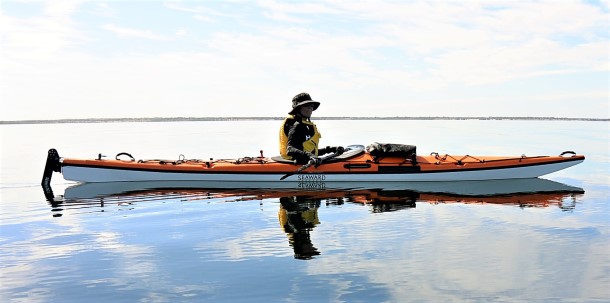
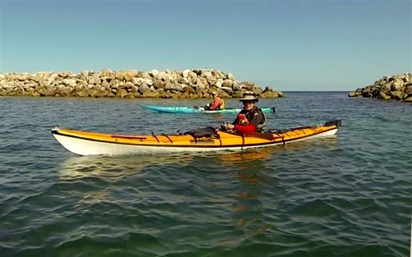
All ready at the Ferry Terminal – Cape Jervis

Steve was determined to get a photo with the three of us in,  which was not an easy task given the darkness but he succeeded.

That’s us… L to R    Steve, Ian and Michael

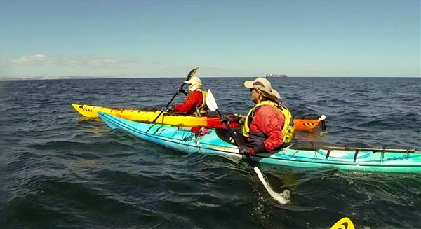
Then it was on the water to clear Cape Jervis before the sun rose. The first couple of kilometers were perfect conditions with almost glassy calm water and the sun peeking through the clouds. We had checked and double checked the forecasts as there was a strange cloud formation over the island, but all seemed perfect including our speed which was over 8km/hr.

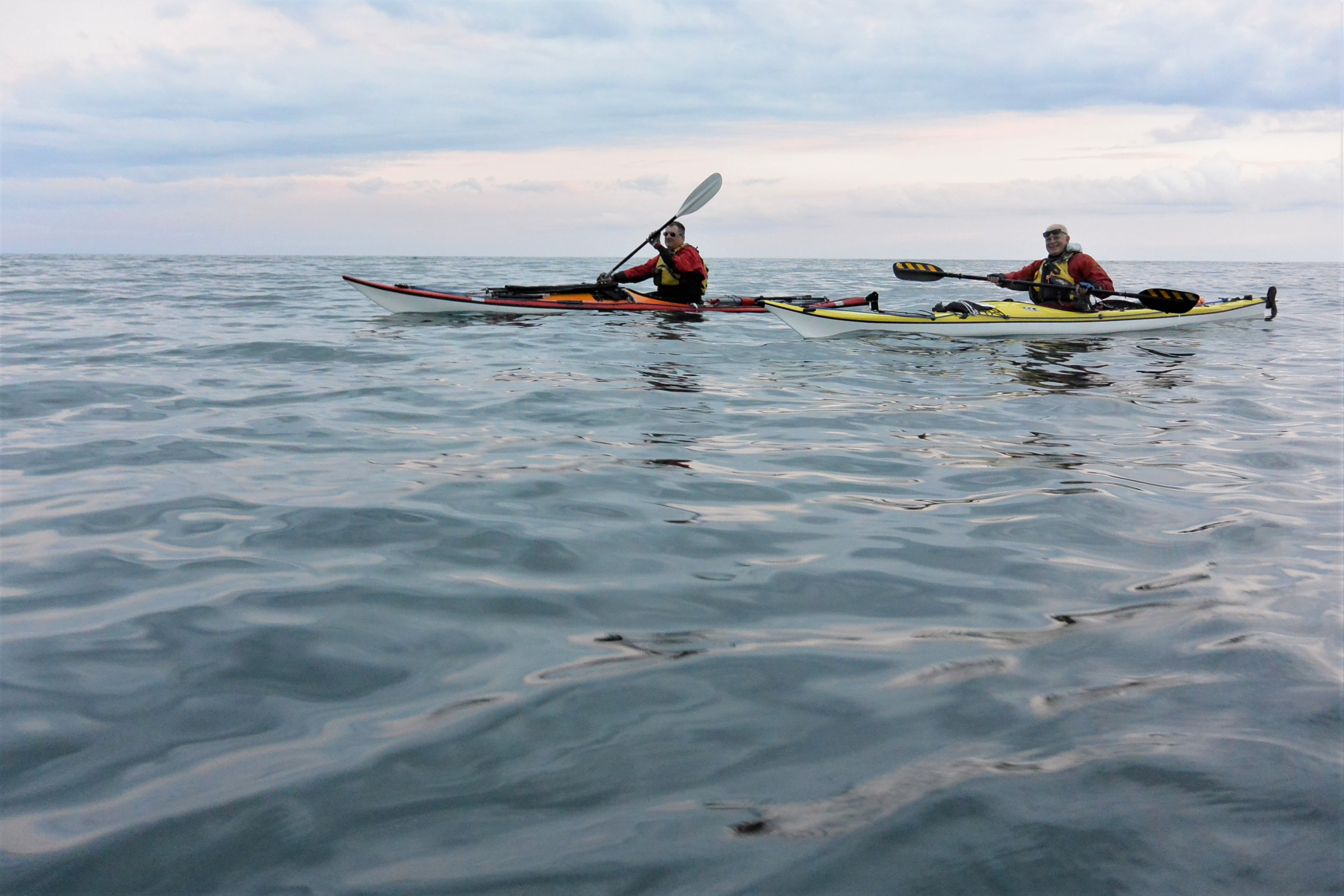
Calm conditions as the sun came up

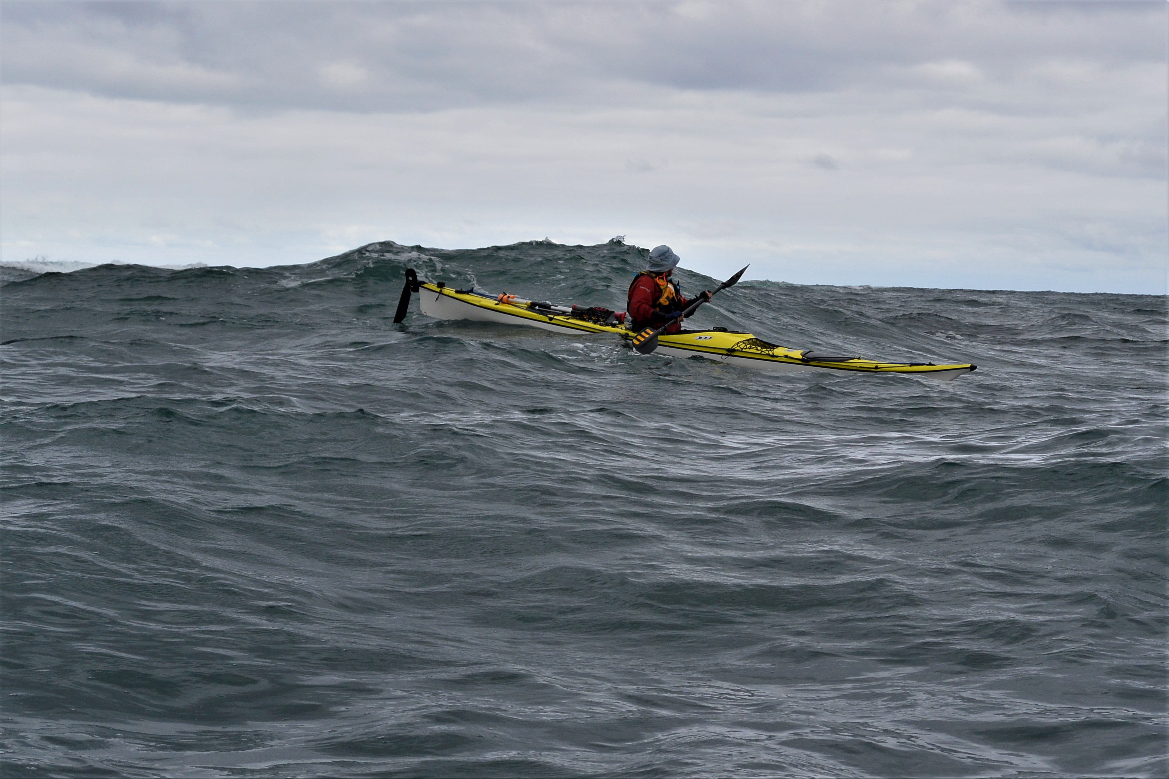
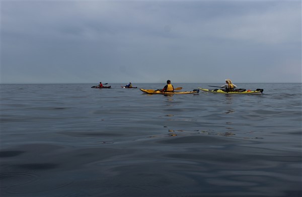
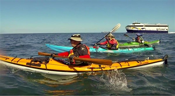
It wasn’t long before we felt a gentle headwind spring up and not much longer before it increased, but our speed was good given the tidal assistance and the laden kayaks easily handled the conditions.

The headwind was increasing creating a confused sea due to the wind against tide

We kept an eye out for traffic as we crossed the shipping channel and this one passed well behind us.

Missed us by a mile

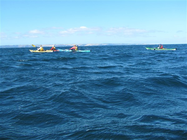
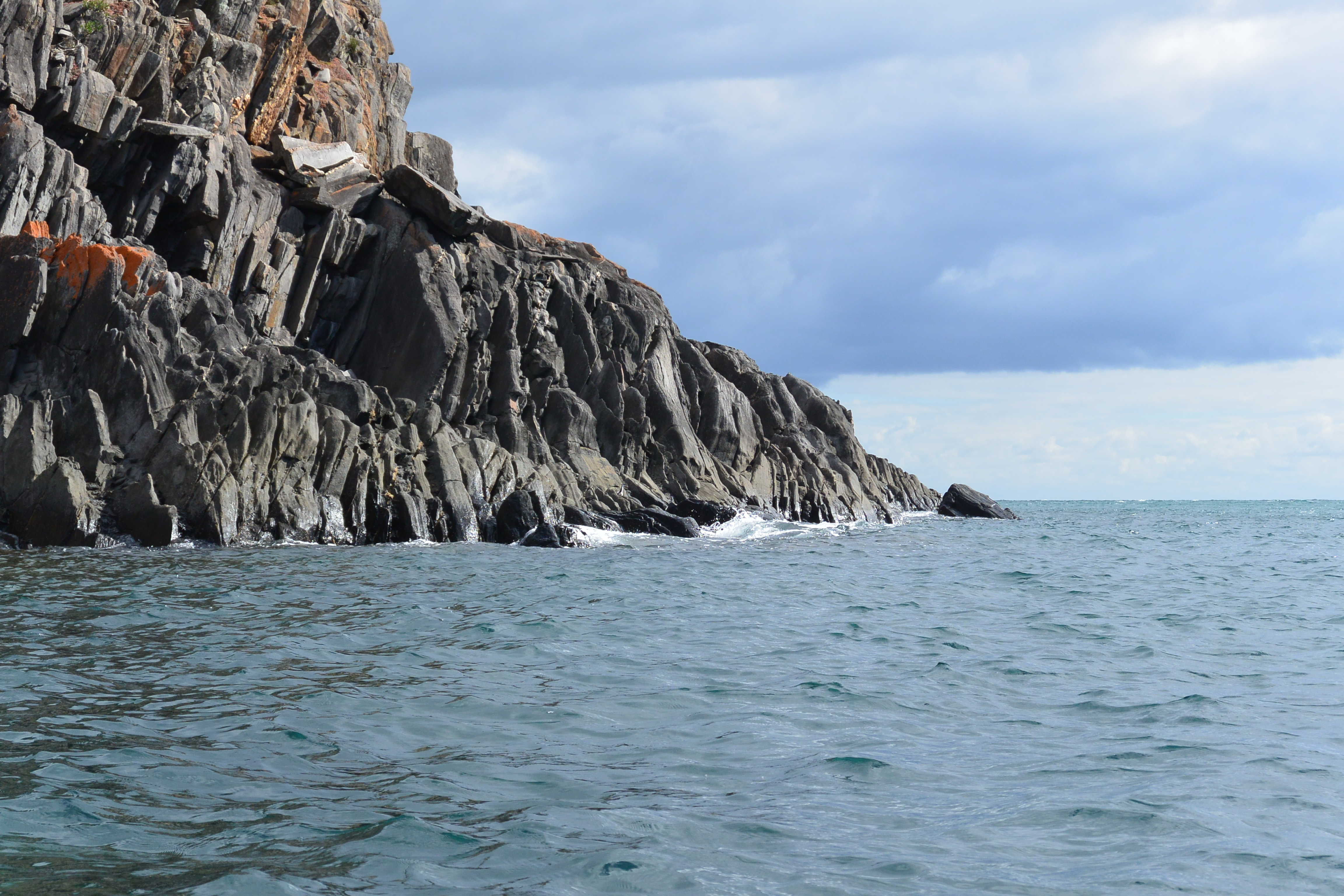
After 3 hours of paddling into the headwind we rested in the wind shadow of the high cliffs of Kangaroo Island, just east of Cuttlefish Bay, with Steve very happy with his first crossing.

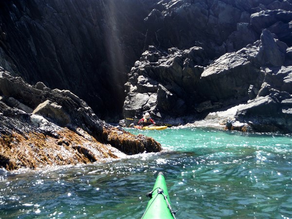
Great coastal scenery for the next few kilometers

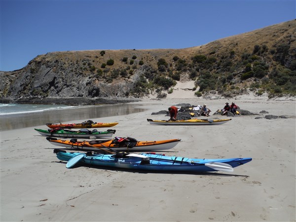
It was then onto our campsite in Antechamber Bay close to the Chapman River.

Out of the wind but not the rain

The good weather didn’t last long with heavy rain setting in for most of the day and night. Still we were prepared with shelter and a good bottle of McLaren Vale red wine kindly supplied by Steve.

A good end to the day

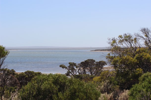
Next morning the rain subsided to occasional light showers as we headed west, hugging the coast to keep out of the wind. The sun occasionally broke through the clouds lighting up patches of the calm waters in Antechamber Bay.

The sun was still shining….well sometimes it was

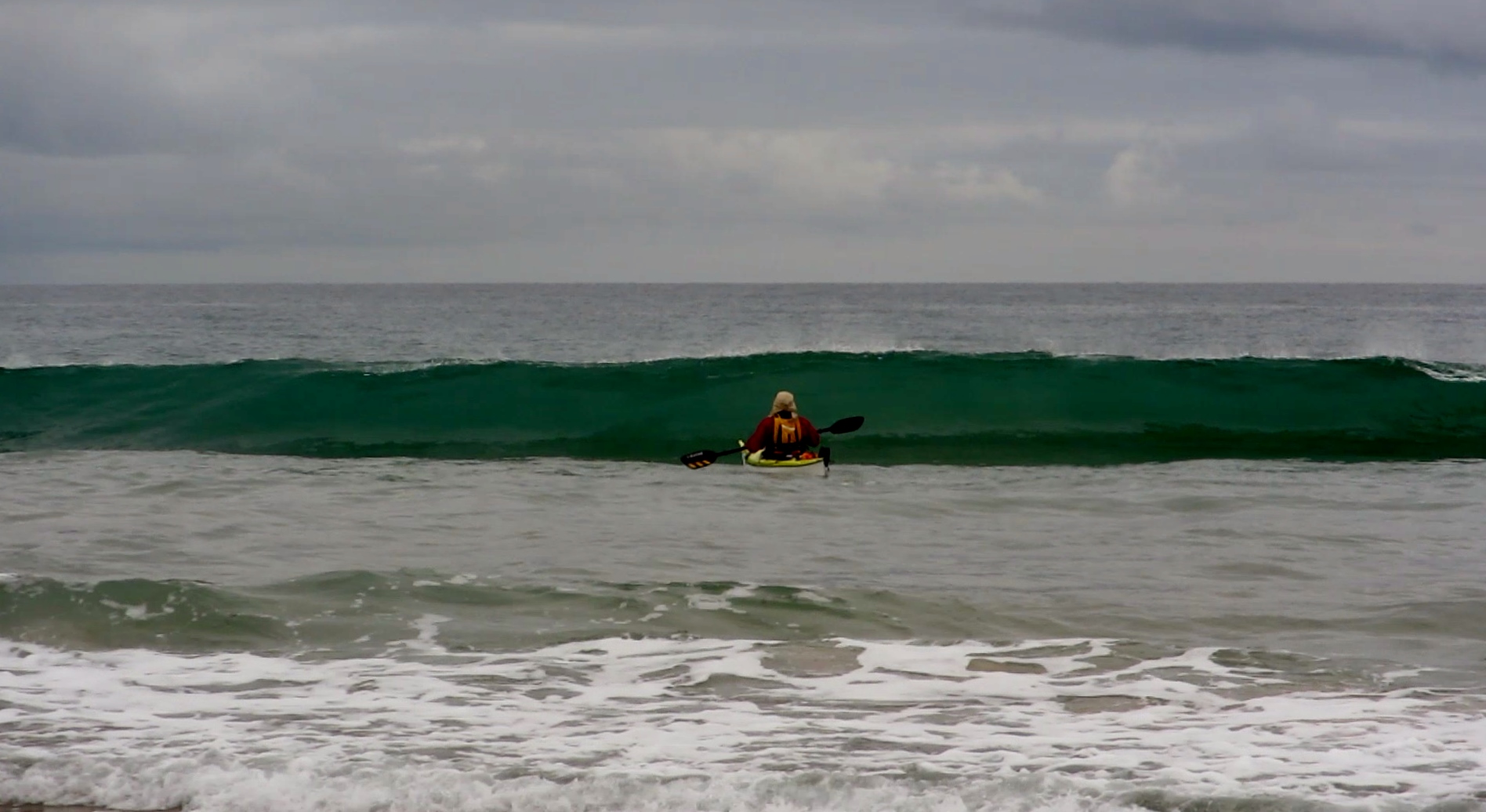
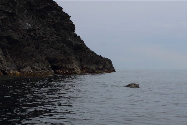
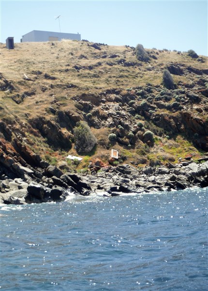
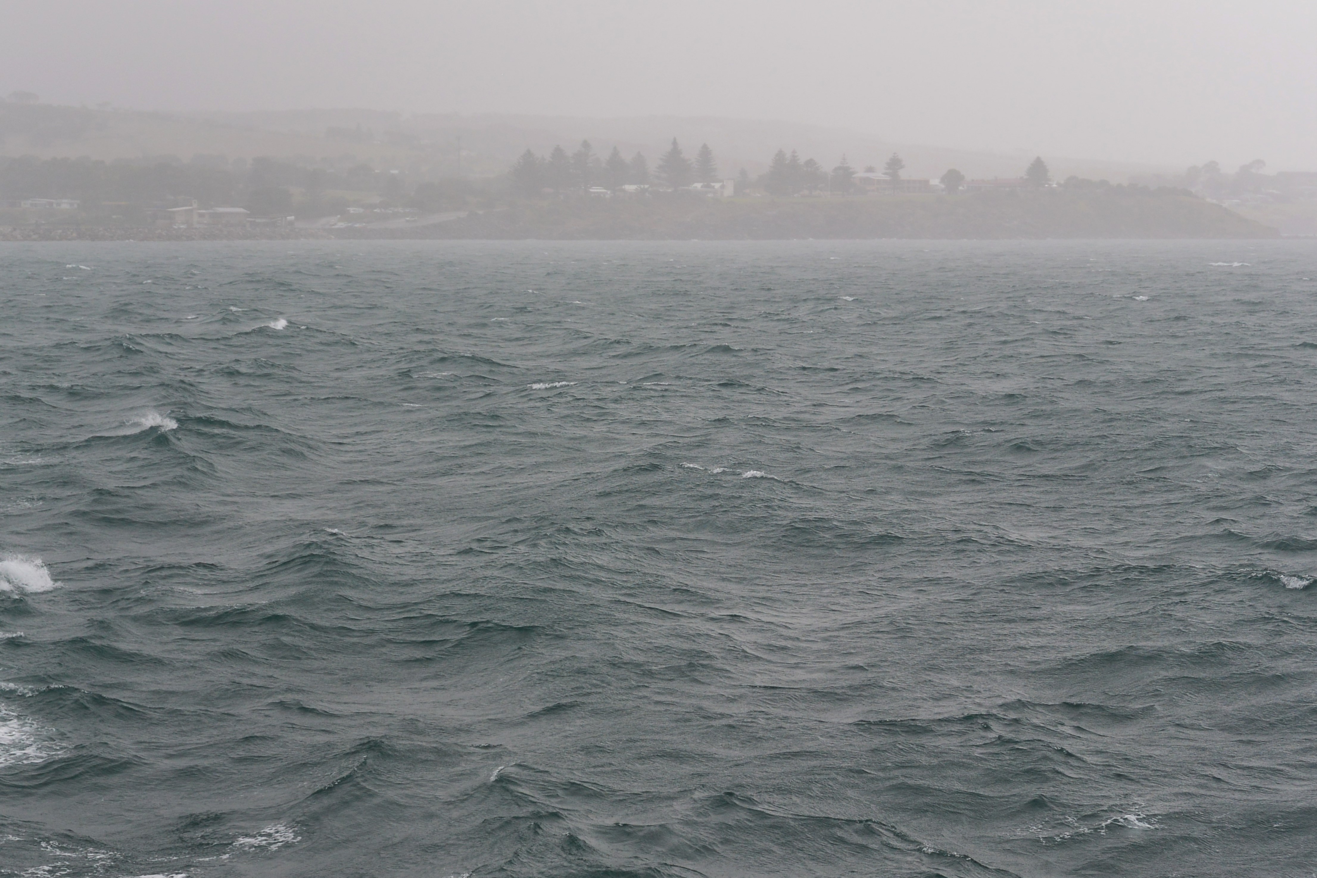
The forecast wasn’t good with a strong wind warning being issued for Investigator Strait and surrounding areas. The prospect of 20-30 knot winds was not pleasant so we hugged the coast and dropped in on the local wildlife.

Calm water as we paddled out from the shelter of Antechamber Bay

The end of shelter in the bay was near

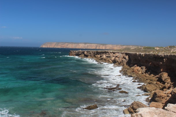
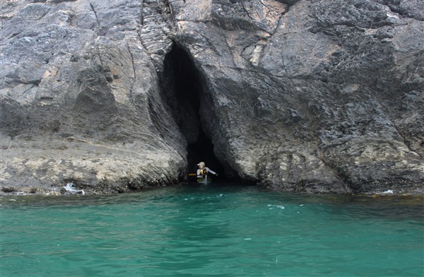
This is a stunning coastline with large tracts of natural vegetation

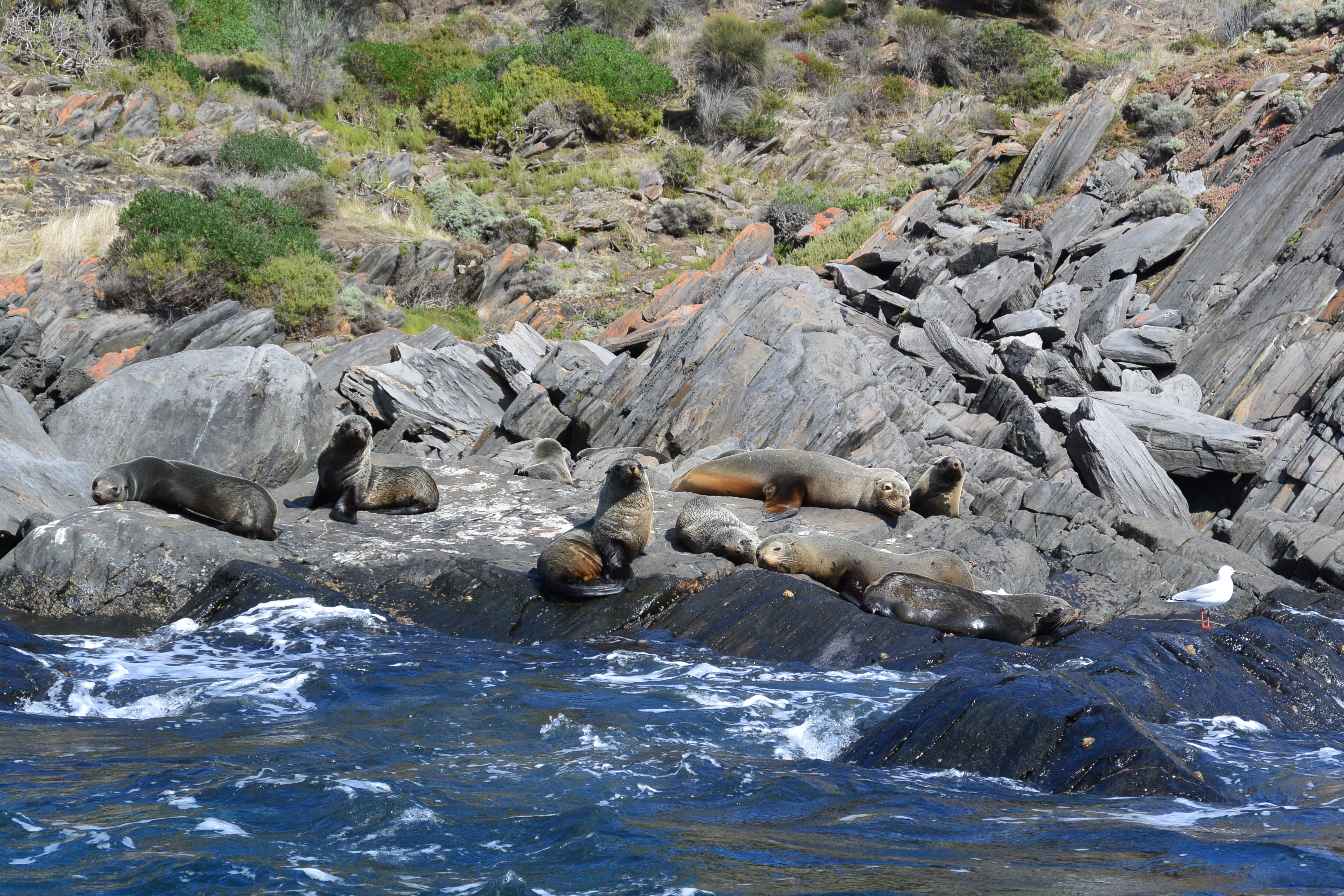
Sea Lions came out to play around the kayaks. Maybe they were the smart ones being ashore for the day

After a 3 hour stretch” on the paddle” we rounded into Hog Bay ……

We arrived just before the storm hit Hog Bay

….and waited to board the “BIG BOAT” that would take us home.
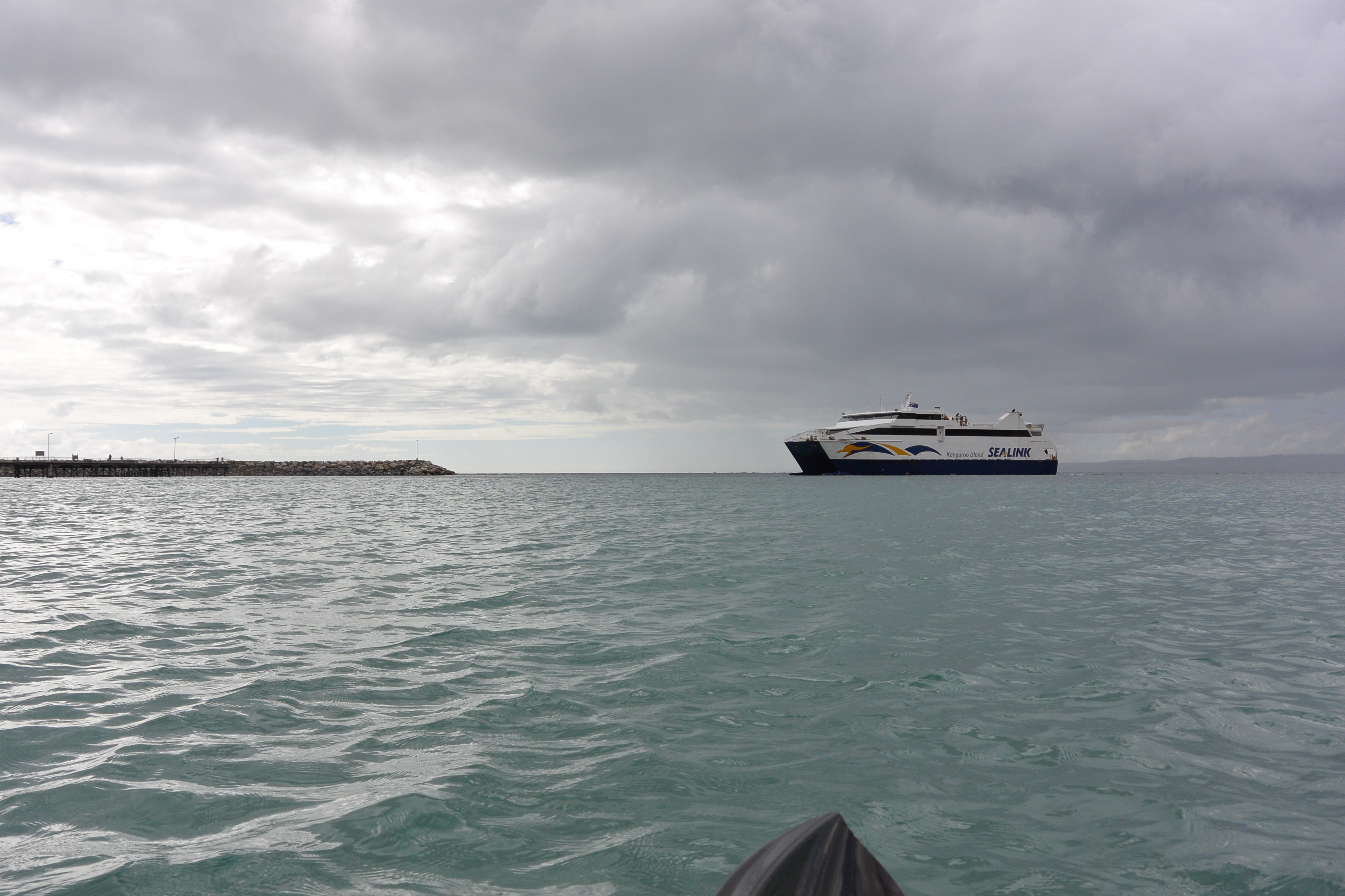
The Sea Link ferry

We quickly organised fares and climbed aboard, sandwiched between cars.

Safe and sound on the car ferry

I have been paddling this stretch of water since the early 1980’s and it’s different every time. Not only was it Steve’s first crossing of the Strait but the first time Michael and  I had come back with our kayaks on the ferry. Another great adventure paddling the coast of South Australia.

Michael

Ian

Steve

Venus and other Gods

Venus is the Greek Goddess of Love and Beauty, among other things, and we have been wandering along a coastline that we certainly Love. Its’ Beauty is in the rugged cliffs and sandy bays that dot the landscape along the western coast of South Australia.

Unfortunately Venus was travelling with Euros the God of the South East Wind and he was displaying his might. For several days now it has blown too strong for us mere mortal kayak paddlers to venture out into Venus Bay and then out into the open Southern Ocean.

Even the locals stayed ashore today. This was inside the calm bay and you can see the whitecaps on the water

Even the locals stayed ashore today. This was inside the calm bay and you can see the whitecaps on the water

Our plan had been to spend a couple of weeks exploring along the rugged coastline, visiting places that we had been before and exploring some new spots. The coastline between Venus Bay and Smoky Bay is especially beautiful from the water with a series of cliffs towering above and lots of small bays and inlets to explore. In the past we had spent many days paddling and swimming with dolphins and sea lions in Baird Bay as well as relaxing on other deserted beaches.

With the wind howling we couldn’t even get the kayaks off the roof of the car, let alone get to any offshore locations or even into the generally sheltered waters of Venus Bay.

Looking out towards the headlands of the protected Venus Bay

Looking out towards the headlands of the protected Venus Bay

So it was onto the FatBikes for some coastal fun around Venus Bay and across to Entrance Beach.

We jumped on the bikes and set off to explore along the coastal dunes

We jumped on the bikes and set off to explore along the coastal dunes

The sign says 4 wheel drive and we had 4 wheels so on we went

The sign says 4 wheel drive only and we had 4 wheels so on we went

After exploring around dunes we visited the Venus Bay Conservation Park which allowed us access to some wind swept but deserted beaches. The drive gets interesting when you reach the track over the and dunes.

You can just spot the kayaks on the roof of the car as we made our way along the track

You can just spot the kayaks on the roof of the car as we made our way along the track. The track is marked by posts as the track is lost in the sand

Robyn “the snake charmer” managed to have a chat with a good size brown snake who took off up the sand dune leaving only his “snake trail” in the sand. We didn’t follow.

Snake trails across the dune which were blown away within minutes

Snake trails across the dune which were blown away within minutes

This area is quite beautiful with views across Venus Bay.

Looking out towards the islands in the bay

Looking out towards the islands in the bay

We spent time sheltering out of the wind along with the local inhabitants.

Some of the locals sheltered with us on the beach

Some of the locals sheltered with us on the beach

The one paddle that I had really hoped to do was a visit to the “Dreadnoughts”, a group of bommies off the coast of Sceale Bay. On a paddle here 17 years ago, with a group of sea kayak instructors, we tried to weave our way through the breaks. Unsuccessfully I might add. The sea was calm and green as we admired a breaking bommie which soon turned to a wall of white foam when a set of rogue waves came through, cleaning up a couple of the group.

Today you wouldn’t want to be out there.

The photo doesnt do justice to the size of the waves as they extend right across the bay

The photo doesn’t do justice to the size of the waves as they extend right across the bay

We dropped into the once thriving town of Port Kenny. It had been a port serviced by the Mosquito Fleet of flat bottom boats that carted wheat and other goods from the towns along the coast, in the early 1900’s but sadly there are only a few houses and a pub left. There are remnants of previous travelers.

This was probably a very up-market model in its' day

This was probably a very up-market model in its’ day

We moved west in hope of better weather and camped at Smoky Bay. The wind still blew as we retired for the night.

We awoke to a hot and still morning. With no wind and clear blue skies we quickly unloaded the kayaks and paddled off to explore Smoky Bay.

A quick dip to cool off before heading out.

A quick dip to cool off before heading out.

Calm and very clear water ahead

Calm and very clear water ahead

Not a breath of wind and we were 2 km from shore

Not a breath of wind and we were 2 km from shore

We paddled for an hour or so to the other side of the bay where there are large numbers of oyster beds.

Oyster beds in the shallow waters of the bay

Oyster beds in the shallow waters of the bay

We saw Cirrus clouds streaking the sky as we turned for home. The wind again started to increase but  at least we had snuck in a good 2 hour paddle for about 900 km of travel and a week of waiting; still that’s sea kayaking for you.

The Reef

Horseshoe Reef. It’s been around for a long time; certainly longer than me and I feel a strange attraction. I remember being on the beach as a child watching the small boats fishing along the inside of the reef. I visited on school holidays, snorkeled out to the reef as a teenager and still explore it regularly by kayak.

The reef is part of the Mullawirraburka dreaming story of the local Kaurna aboriginal people telling how Mullawirraburka threw his spear into the water to bring the fish closer to the shore forming the reefs of Pt. Noarlunga and Christies Beach.

As the name suggests the reef is formed in an arc with the open end pointing to shore. On the seaward side the reef drops from a steep platform to a  flat expanses of stone and toward shore the reef becomes steeper then drops into 5m of water.

The reef is seldom flat calm. More often there is a confused sea caused by the meeting of waves but always it’s a fun place to hang out.

The outer steep reef edge generates a powerful wave which wraps around both ends of the reef  and in the right conditions these left and right waves peel around the horseshoe shape in opposite directions to collide with huge force.

That’s where the fun begins. You can catch a small wave heading south only to be met with one coming north and you are often spat out upwards; or sometimes you are just buried by a few ton of water. You might come back up the right way but not always.

Steve playing around on a calmer day……dsc_0461

The reef is a place for experienced paddlers and on the right day is an excellent place to put a few sea kayak skills to the test.

Steve8

The Reef on a stormy day

The Reef on a stormy day

But beware the dangers below as there is not only the reef to worry about but also its inhabitants. I guess we may not be the only ones enjoying the reef today.

dsc_0470-2

Get out and enjoy our local area but remember to “keep it safe” and stay within your ability.

Cheers
Ian Pope


Steve King of the shorebreak

It’s late Autumn. The mornings are cooler now as we waited for the first rays of light to slowly rise over the Mt Lofty Ranges bringing a soft light if not warmth. The beach sand is cold on the feet.  You can hear the loud thud of the shorebreak almost drowning out the bark of a dog on it’s early morning run.

A guy riding a mountain bike with multiple flashing lights appears and he’s towing a kayak. That’s him; Steve King “King of the Shorebreak” here for his regular morning paddle and I have been crazy enough to join him.

Within a few minutes he has unhooked the kayak and is ready for another early morning paddle along the coastline. The first task is to negotiate the shorebreak and thankfully it seems quieter than normal although there are several lines of waves to negotiate.

Out through the first line of waves

Out through the first line of waves

Sometimes there a lull in the waves so you get through the first line easily……

Sometimes there a lull

Sometimes there a lull

……only to find the second line waiting for you.

About to get very wet

About to get very wet

The wind was light so we we headed along the coast stopping to play in waves generated by the offshore reefs. These waves can be savage at times as they break over the shallow reef shelf, however, today they were just lots of FUN.

Steve launches of the top of a small wave

Steve launches off the top of a small wave

Hey Steve…Just paddle over there. I think I can get a good photo.

Yep. He's in there somewhere

Yep. He’s in there somewhere

We bounced around for quite a while, enjoying the waves cascading across the reef in all directions.

Managing to keep control

Managing to keep control

The turbulence of the bluff

The turbulence off the bluff

We sat in the lee of a large chunk of reef and enjoyed the scenery.

Checking out an exposed rock

In the lee of the reef

That’s lots of fun on an early morning paddle, but I have housework to do, so it’s back to the run the shorebreak again.

Trying to come in on the back of a wave can work sometimes...but not always.

Trying to come in on the back of a wave can work sometimes…but not always.

You get through the outer line to find more surprises waiting for you.

Caught between 2 lines of waves

Caught between 2 lines of waves

And sneaking through the quiet part of the break we caught the last wave of the day.

and then the last wave home

the last wave home

Just in case you thought that some of the photos were a little blurred, think about this. I was in there with him, using a dinky toy Canon waterproof camera in one hand, meaning that I had only one hand on the paddle. This was quite often an interesting position to be in; but lots of FUN…. Ian

Ian                                                                        Steve
ian smurf crop (2)

king

The “Seal of Approval”

Another 38°C (100° F) day was forecast, just rounding out another week of heat. So what to do today ?. The last week had seen strong, hot winds blowing across the Adelaide Plains but today was different. NO wind or just a gentle breeze perhaps, so it was load up the kayak and hit the water.

And indeed there was NO wind or maybe just a wisp of a breeze, hardly enough to evaporate the sweat from the brow but perfect conditions combined with an extremely low tide to do a little exploring. The sky was overcast, covered with tropical layers swirling from the north. The horizon blended into the sky making an eerie landscape and the cliffs stood dark and quiet.

The water was crystal clear and you could easily pick out the bottom at 6 metres.

Crystal clear water

Crystal clear water

Clear water and steep cliffs

Clear water and steep cliffs

We explored a little along the rugged coastline.

Michael drifting along

Michael drifting along

Shaun exploring a small crevice

Shaun exploring a small crevice

This way is a bit squeezy in a Seaward Passat Double kayak

This entrance is a bit squeezy in a Seaward Passat Double kayak… but we manage

Steve in close inspection

Steve in close inspection

Shauna tries not to scratch the new kayak

Shauna tries not to scratch the new kayak

Whats around the corner ?

Whats around the corner ?

Clear waters

Clear waters

We drifted along a little, with no plans to be anywhere at any particular time.

Just floating

Just floating

The photographer

The photographer

….and we were not the only ones enjoying the day.

New Zealand Fur seals enjoying the calm waters

New Zealand Fur seals enjoying the calm waters


We are not alone. Three other kayaks also enjoying the day.

We are not alone. Three other kayaks also enjoying the day.

We got ourselves in a few tight places with the slightest of swells gently moving the kayaks in and out of rock crevices.

Shaun again and the crevices are getting smaller

Shaun again and the crevices are getting smaller

It was a great day on the water.

Calm waters

Calm waters

We just needed one more thing..and there he was ..the kayakers “Seal of Approval”.

The "Seal of Approval"

The “Seal of Approval”


Photos by Ian and Shauna

ian smurf crop (2)stick shauna


Kayak drifting by
Shaun                                 Steve                 Michael                     Robyn

jim2kingYogi bearRobyn

The Blowhole

Sea kayak Day Paddle – Cape Jervis to Blowhole Beach.  Actually there isn’t really a blowhole there, not like the type we normally think of where towering waves crash onto a rocky coastline sending plumes of spray skywards. This is Blowhole Creek  in the Deep Creek National Park and one of the picturesque beaches along this very rugged coastline. I have been visiting this beach for the last 40 years and the only thing that has changes is that you can now access it via a 4WD track from within the National Park. In the old days it was a rocky walk down a rough track or straight down the fence line on Cobblers Hill.

This area has a tidal stream of up to 3 knots as water empties and refills the Gulf St Vincent so all paddling needs to be planned with the tides.  My many years experience paddling this coast have also taught me to be very cautious of forecasts and take more notice of the conditions at the time as well my own observations.

The weather forecast a couple of days out had been for smooth seas and light winds so we planned a trip along the coast from Cape Jervis to Blowhole Creek and return. We gathered 5 local paddlers together with the idea of exploring the rocky coastline up close, if the weather forecast was correct.

The "5 fine young men" ready for action

The 5 “fine young men” ready for action

Arriving at Cape Jervis we found that the Backstairs Passage between the mainland and Kangaroo Island was just starting to have white caps on the horizon, stirred up by a Sou’Easterly breeze. Great….another day of headwinds and certainly not what we had hoped for but inshore it would be much calmer.

We got organised and waited in the shelter of the marina for the Kangaroo Island ferry to leave.

Waiting for the KI ferry to leave

Waiting for the KI ferry to leave

Then we plodded off into the increasing gusts.

Michael and Steve

Michael and Steve

Of course there is a shipping lane in Backstairs Passage so you need to keep a wary eye on the horizon.

The Ferry and Container ship crossing paths

The Ferry and Container ship crossing paths

Sean and Michael in the protected waters

Sean and Michael in the protected waters

Heading out of the protection of Cape Jervis. Kangaroo Island in the distance.

Heading out of the protection of Cape Jervis. Kangaroo Island in the distance.

Looking at my GPS I thought “ Hey this was supposed to be an easy paddle riding the ebb tide, but we are only making 5km/hr in the strengthening wind. We decided to stay close inshore and use the headlands for protection from the breeze.

Paddling close inshore to avoid the winds.

Ian showing the way.

We reached Lands End and passed close in at Whites Beach where the underwater power cable goes to Kangaroo Island.

Staying in close

Staying in close

We soon arrived at the more interesting section of the paddle, where the steep cliffs fall straight into the water.

Clear water and shelter from the wind

Clear water and shelter from the wind

This allowed us to get up close and personal with the rocks and swell. As usual Steve was found bobbing around among the rocks.

Steve inspects another crevice

Steve inspects another crevice

Rugged coastline

Rugged coastline

Inspecting the rocky coastline

Inspecting the rocky coastline

We “played” our way along the coast to Naiko inlet which is a small inlet with sandy beach. There we spotted the first signs of life for the trip. Maybe Alien life was a better description as we spotted a spaceship landed among the native bush.

Signs of life on the hill

Signs of life on the hill

A closer view of the landing spot

A closer view of the landing spot

Soon Cobblers Hill was in sight with Blowhole Beach just around the headland. We could see bushwalkers on the Heysen Trail which runs 1200 km from Victor Harbor to Parachilna Gorge in the northern Flinders Ranges.

One more headland to go

One more headland to go

A landing through small surf got us onto the pristine beach for lunch.

Blowhole Beach

Blowhole Beach

Rodney surprised with a bowl of fresh strawberries, cherries and grapes to share. Who said he’s disorganised ??

The lunch spot

The lunch spot

Looking SW

Looking SW

Looking towards Kangaroo Island

Looking towards Kangaroo Island

Then back on the water through a small surf we found that the wind had abated slightly but still gave us an easy ride home as we picked up the start of the flood tide.

Steve on the way out

Steve on the way out

Again we played around in  some rock gardens resulting in me high and dry on rocks. (sorry no photos !!)

Having fun

Having fun

Among the rocks again

Among the rocks again

Checking out a small ravine

Checking out a small ravine

Many years ago some intrepid fisherman built a “get away” on the headland which is now complete with TV antenna. Unfortunately you can see that the “room with a view” has lost its’ door to a recent gale and now resides at the bottom of the cliff. Still your hardly likely to get too many interruptions here.

Room for one

Room for one

We arrived back at Cape Jervis just in time to see the Kangaroo Island ferry heading out for Penneshaw. A great way to spend a day on this mainly deserted coastline with a pristine beach lunch stop.

Arriving at the Cape as the ferry departs

Arriving at the Cape as the ferry departs

This is an excellent place for exciting paddling especially as the swell and associated clapatis increases. It should only be paddled by those with the appropriate sea skills and of course a properly fitted out sea kayak.

Happy Paddling
Ian Pope

blowhole (2)


Starting point. Cape Jervis
Distance. 18km return
Hazards. This area is subject to a tidal stream of up to 3 knots so paddlers must take this into account on all trips. Note that South Australia has “dodge tides” and more information is available from the Bureau of Meteorology website (bom.gov.au). There are many reefy/rocky areas along the coast as well as the possibility of large breaking waves with the predominant swell being from the SW. There are limited landing spots along this coast even in good conditions. Take care and seek local knowledge.

Chart AUS 780

Paddlers and Photographers Ian, Shaun, Steve, Michael and Rodney

ian smurf crop (2)

jim2 king Yogi bear Sir Rodney Hubert Biggs