Venus and other Gods

Venus is the Greek Goddess of Love and Beauty, among other things, and we have been wandering along a coastline that we certainly Love. Its’ Beauty is in the rugged cliffs and sandy bays that dot the landscape along the western coast of South Australia.

Unfortunately Venus was travelling with Euros the God of the South East Wind and he was displaying his might. For several days now it has blown too strong for us mere mortal kayak paddlers to venture out into Venus Bay and then out into the open Southern Ocean.

Even the locals stayed ashore today. This was inside the calm bay and you can see the whitecaps on the water

Even the locals stayed ashore today. This was inside the calm bay and you can see the whitecaps on the water

Our plan had been to spend a couple of weeks exploring along the rugged coastline, visiting places that we had been before and exploring some new spots. The coastline between Venus Bay and Smoky Bay is especially beautiful from the water with a series of cliffs towering above and lots of small bays and inlets to explore. In the past we had spent many days paddling and swimming with dolphins and sea lions in Baird Bay as well as relaxing on other deserted beaches.

With the wind howling we couldn’t even get the kayaks off the roof of the car, let alone get to any offshore locations or even into the generally sheltered waters of Venus Bay.

Looking out towards the headlands of the protected Venus Bay

Looking out towards the headlands of the protected Venus Bay

So it was onto the FatBikes for some coastal fun around Venus Bay and across to Entrance Beach.

We jumped on the bikes and set off to explore along the coastal dunes

We jumped on the bikes and set off to explore along the coastal dunes

The sign says 4 wheel drive and we had 4 wheels so on we went

The sign says 4 wheel drive only and we had 4 wheels so on we went

After exploring around dunes we visited the Venus Bay Conservation Park which allowed us access to some wind swept but deserted beaches. The drive gets interesting when you reach the track over the and dunes.

You can just spot the kayaks on the roof of the car as we made our way along the track

You can just spot the kayaks on the roof of the car as we made our way along the track. The track is marked by posts as the track is lost in the sand

Robyn “the snake charmer” managed to have a chat with a good size brown snake who took off up the sand dune leaving only his “snake trail” in the sand. We didn’t follow.

Snake trails across the dune which were blown away within minutes

Snake trails across the dune which were blown away within minutes

This area is quite beautiful with views across Venus Bay.

Looking out towards the islands in the bay

Looking out towards the islands in the bay

We spent time sheltering out of the wind along with the local inhabitants.

Some of the locals sheltered with us on the beach

Some of the locals sheltered with us on the beach

The one paddle that I had really hoped to do was a visit to the “Dreadnoughts”, a group of bommies off the coast of Sceale Bay. On a paddle here 17 years ago, with a group of sea kayak instructors, we tried to weave our way through the breaks. Unsuccessfully I might add. The sea was calm and green as we admired a breaking bommie which soon turned to a wall of white foam when a set of rogue waves came through, cleaning up a couple of the group.

Today you wouldn’t want to be out there.

The photo doesnt do justice to the size of the waves as they extend right across the bay

The photo doesn’t do justice to the size of the waves as they extend right across the bay

We dropped into the once thriving town of Port Kenny. It had been a port serviced by the Mosquito Fleet of flat bottom boats that carted wheat and other goods from the towns along the coast, in the early 1900’s but sadly there are only a few houses and a pub left. There are remnants of previous travelers.

This was probably a very up-market model in its' day

This was probably a very up-market model in its’ day

We moved west in hope of better weather and camped at Smoky Bay. The wind still blew as we retired for the night.

We awoke to a hot and still morning. With no wind and clear blue skies we quickly unloaded the kayaks and paddled off to explore Smoky Bay.

A quick dip to cool off before heading out.

A quick dip to cool off before heading out.

Calm and very clear water ahead

Calm and very clear water ahead

Not a breath of wind and we were 2 km from shore

Not a breath of wind and we were 2 km from shore

We paddled for an hour or so to the other side of the bay where there are large numbers of oyster beds.

Oyster beds in the shallow waters of the bay

Oyster beds in the shallow waters of the bay

We saw Cirrus clouds streaking the sky as we turned for home. The wind again started to increase but  at least we had snuck in a good 2 hour paddle for about 900 km of travel and a week of waiting; still that’s sea kayaking for you.

Seascapes

It was  one of those strange sort of days where you stand on the beach ready to launch, still unsure that the weather will behave. That strange bank of low cloud on the horizon, the headwind whipping up a small chop offshore and the thundery looking cumulus clouds to the east.

The winter has been cold and windy this year and we have had to cancel many planned kayak trips, instead spending the time on mountain bikes, (some of our photos are here and here) so we were looking forward to getting a couple of days on the water.

A check of the latest forecasts and current weather observations, for the next 2 days, was certainly within our limits, so it was “Westward Ho”. For Rodney and Steve it would be their first visit to the south western coast, with Ian having explored there many times over the years.

IMG_1309

The first thing that we encountered was the possibility of paddling blind in a sea fog, because sure enough that low cloud was a sea fog rolling straight at us.

IMG_1308

Luckily it just seemed to skirt around us, leaving us an easy passage, in a slight headwind, towards the exposed western side of Wardang Island. After a couple of hours paddling the wind did as predicted and moderated giving us a beautiful day of paddling along the coast.

We visited the local Pied Cormorant colony.

DSCF6014

DSCF6043

The thundery clouds passed us well to the east, making Rodney a happy boy.

IMG_1320

The beauty of this area is definitely the seascapes and the exhilaration of paddling among the  jumble of jagged rocks, passing the graves of several ship wrecks. It’s hard to do the area justice with  just a “point and shoot camera”, bobbing around in a kayak but we hope you like our efforts.

DSCF6352

There are always places you have to explore more closely.

DSCF6162

DSCF6184

DSCF6222

Our lunch spot couldn’t have been more idyllic. A protected beach on a deserted island.

DSCF6124

The afternoon light on sea stacks made for interesting effects.

DSCF6192

DSCF6203

DSCF6226

Sometimes it looked like collapse was imminent…….

DSCF6269

and other areas had long since collapsed.

DSCF6280

Legend has it that munitions were stored here during WW2, although I have never climbed into the chamber to confirm.

IMG_1339

We finished the day camped on a smaller island.

DSCF6296

Watching the sunset whilst enjoying some classic Shiraz wines, from the McLaren Vale and Clare Valley wine regions, along with local cheese and olives and lots of other goodies. What could be better than that ?.

DSCF0299

DSCF6307

DSCF0108

Next day the wind failed to cooperate, being head on all day. We explored more areas along the coast…..

DSCF6097

….before heading across open water to check out Green Island. Locals say that 60 years ago a hermit lived on the island in a small house he had built from shell grit and cement blocks. The house is  still standing (just) and you can also see where he had built rock fish traps.

DSCF6374

So we said farewell to the Pied Cormorants and started the headwind slog back to civilisation.

Paddlers and photographers.

Sir Rodneypope2


king


Rodney                               Ian                                        Steve


Paddling the Scraper

“We were 73 days out from San Francisco. and entering Backstairs Passage, with less than a days’ sailing to our destination.”

“When we passed CapeWilloughby there was a strong south-east gale with a heavy sea. All hands were on deck and the vessel was running before the gale. I kept the vessel as close on to the western shore as I judged it was safe, as by so doing I would be able to shape a course for Cape Jervis….. Just at this time, as we were entering the passage, to my surprise the vessel struck the outer edge of the Scraper (reef). The wheel was at once put hard down, so as to get farther out, but the next sea hurled her farther in, and the vessel would not answer the helm.”

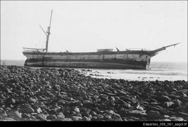
That was the fate of the 4 masted Schooner “Kona” in 1917, bound for South Australia with a load of lumber from San Francisco and their introduction to the Scraper Reef off the coast of Kangaroo Island. Luckily the 11 crew were able to launch a lifeboat and were washed into the calm waters of Antechamber Bay.

Fortunately our meeting with the Scraper was in very different weather conditions. We had decided to paddle across Backstairs Passage, which is a particularly turbulent stretch of water dividing Kangaroo Island from the mainland. Conditions are made interesting by a 3kn tidal current being squeezed through the Passage as well as the Yatala Shoals, although the Autumn neap tide suggested calmer seas.

Our plan was to paddle across Backstairs Passage to Antechamber Bay and set up camp, paddle the Scraper in calm conditions the following day, then catch a tide back to Cape Jervis on the mainland the next day. With luck we could also venture a few kilometres further along the east coast to land on the tiny beach at Pink Bay near Cape Willoughby Lighthouse, which is the most eastern point of Kangaroo Island.

No mistakes; no miscalculations; extreme caution was in order as getting caught in the wrong place or the wrong tidal stream can mean being swept southwards. Michael and I had done this crossing many times in various conditions but it was Rodney’s first crossing. He had been putting in many hours training in the kayak, not only doing endurance work but lots of sessions paddling the coast in windy, sloppy conditions combined with many sessions handling large surf waves.

We had picked a Neap tide to cross the Strait as the tidal movement would be minimal. The forecast in the morning was for 11kn SE which is a cross wind that would be blowing against the Ebb tide flow. Wind against tide always makes for a very choppy passage and with that in mind we set off from Cape Jervis.

Day 1.
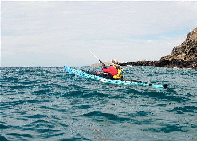
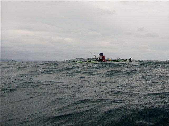
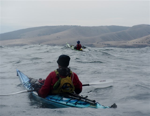
The predicted 11kn SE wind rose to about 15kn soon after departure and went more to a ESE direction giving us a side on sea of around 1m. Lots of white caps and sloppy conditions but easily handled.

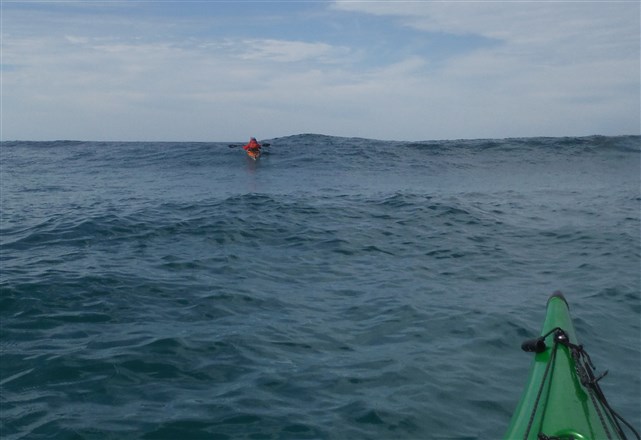
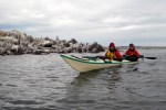
Riding the beam on swells into Backstairs Passage


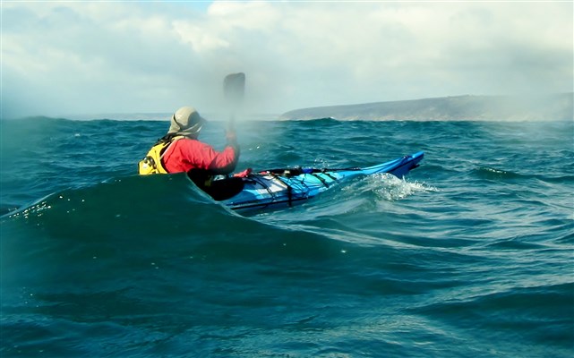
Short choppy waves hitting beam on

We were able to use the side sea  to our advantage, often catching small runs that picked up the laden kayaks. The crossing took 2hr 15m and was generally uneventful except for a few waves that pitched up suddenly and landed a ton of water on your shoulder. It’s also a little difficult taking photos in these conditions, so please excuse our defects.

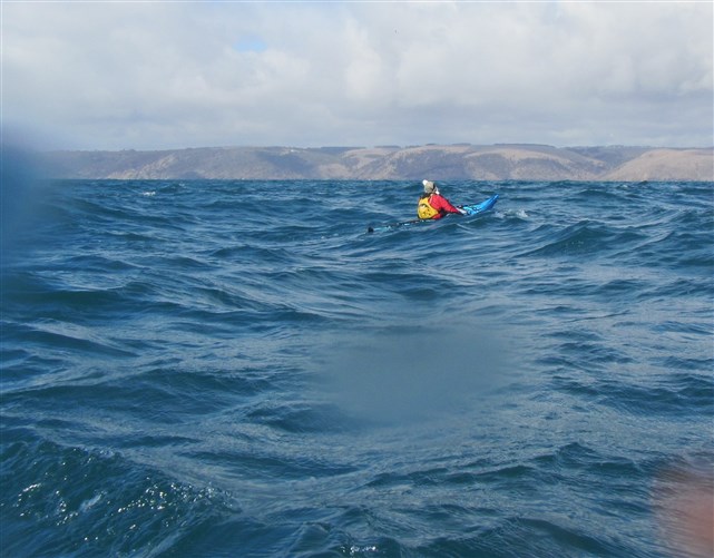
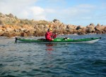
Kangaroo Island approaching

We just missed running over a wooden pallet that had been floating for some time, given the number of barnacles on it.

Floating Flotsam

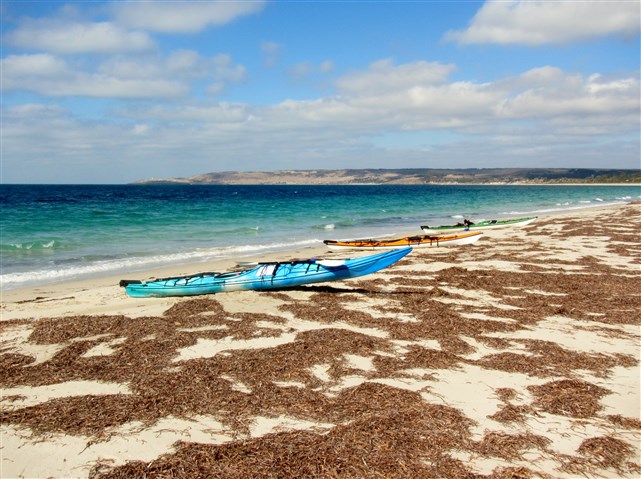
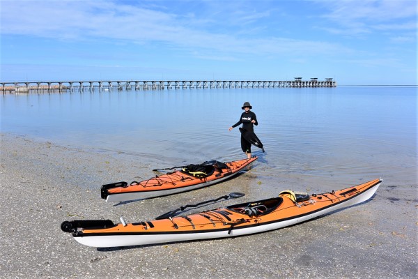
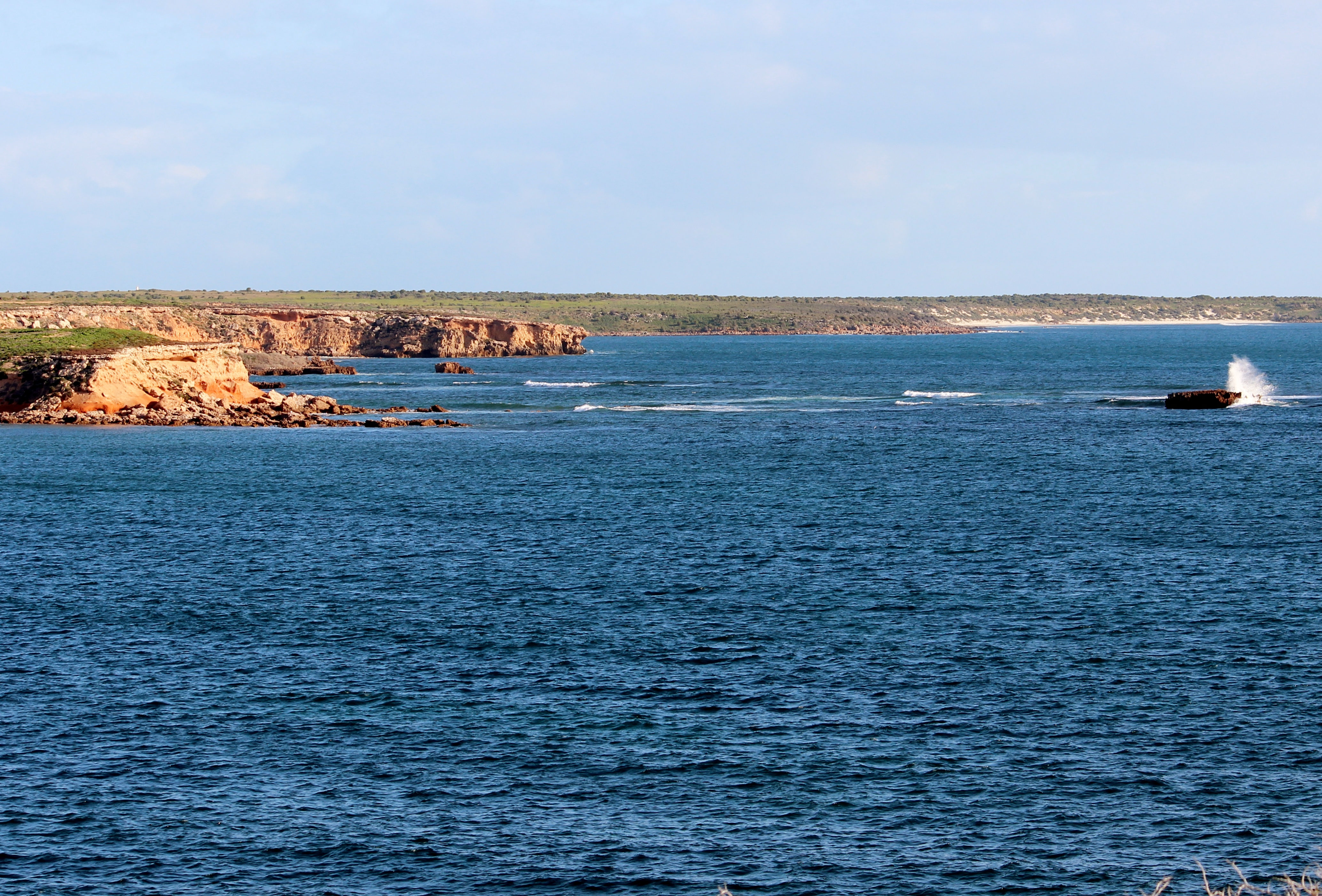
We had made a couple of course changes during the paddle as we found the wind was holding us further west than we had originally calculated. We hit the shore of Kangaroo Island at Cuttlefish Bay, a tiny sandy bay only accessible by water, exactly as planned.

Arriving Cuttlefish Bay


Cuttlefish Bay. Emergency landing spot if needed.

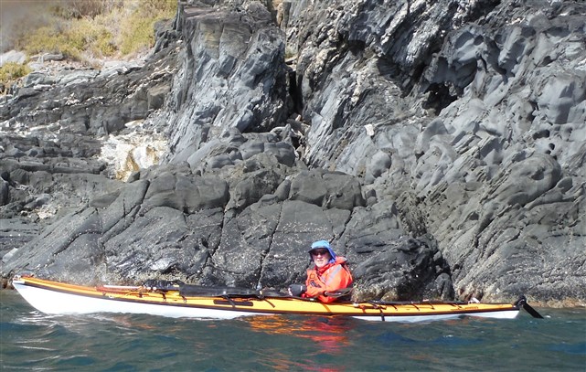
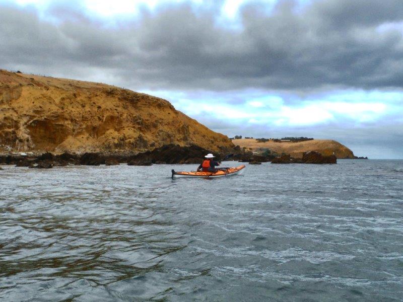
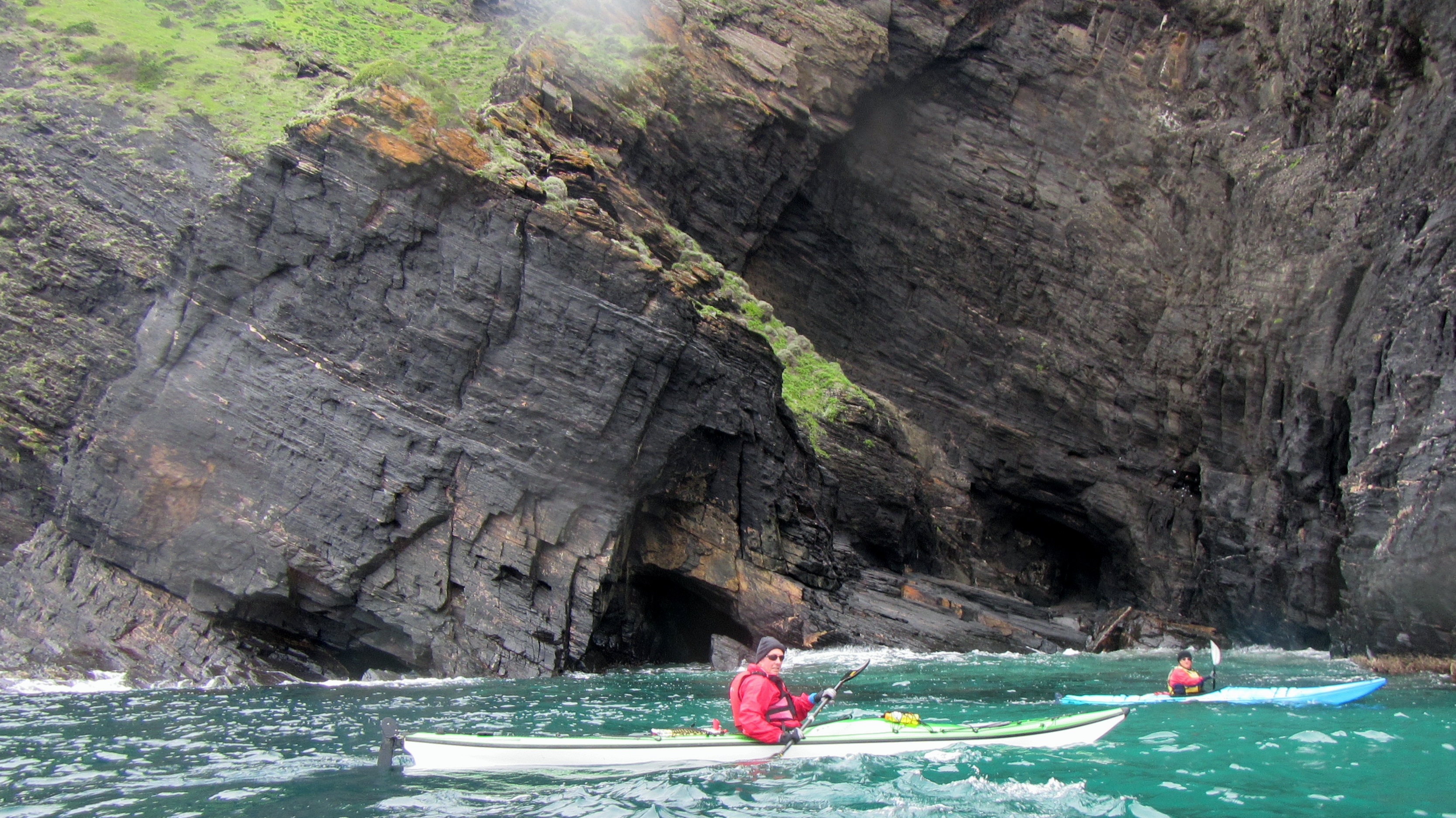
The next job was to push east on the last of the Ebb tide and into a wind that had now gone even more easterly. This meant no protection provided by the high cliffs and lots of boiling clapotis on every small headland. The next 8km took us another 2hr  of hard paddling before we rounded the headland into Antechamber Bay.

Working our way along the cliff face. Resting out of the wind.


All smiles as we head into the wind
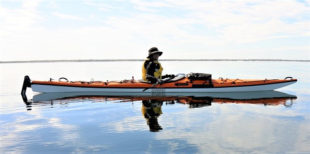
 

The Navigator

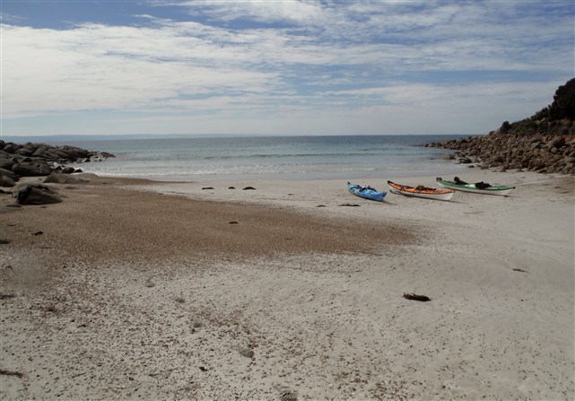
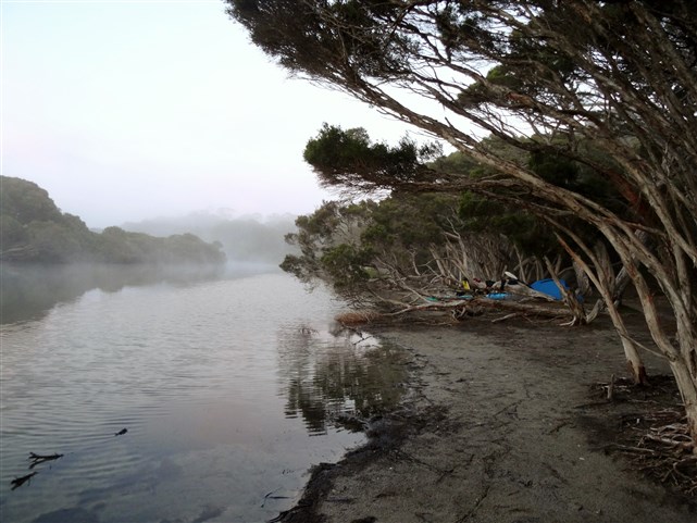
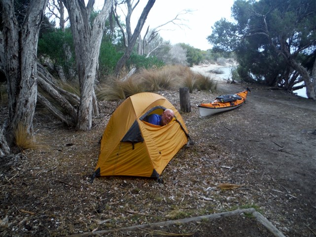
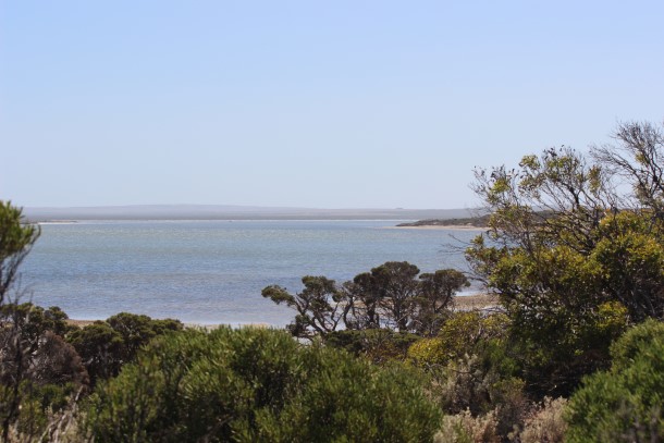
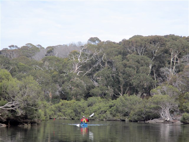
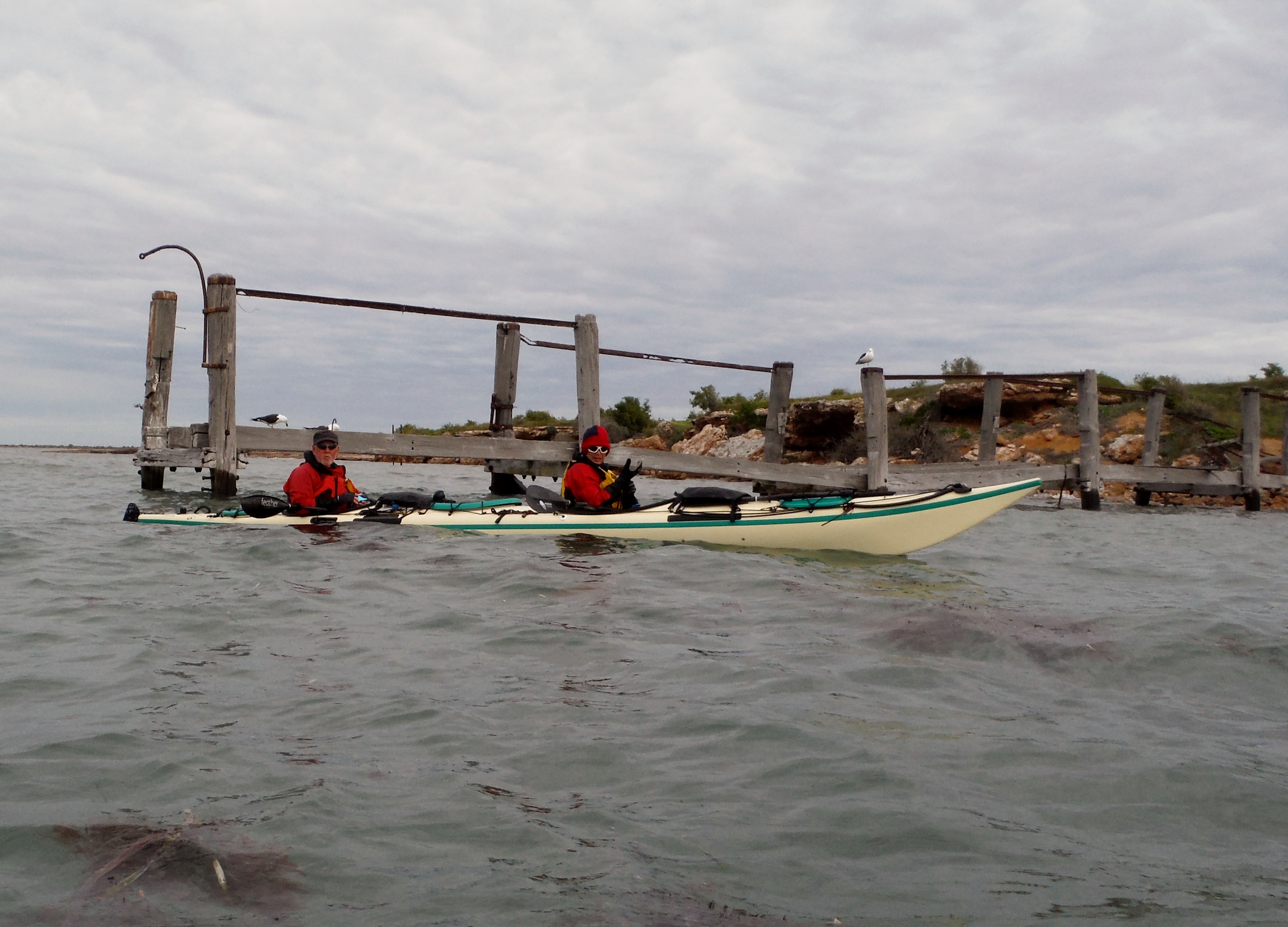
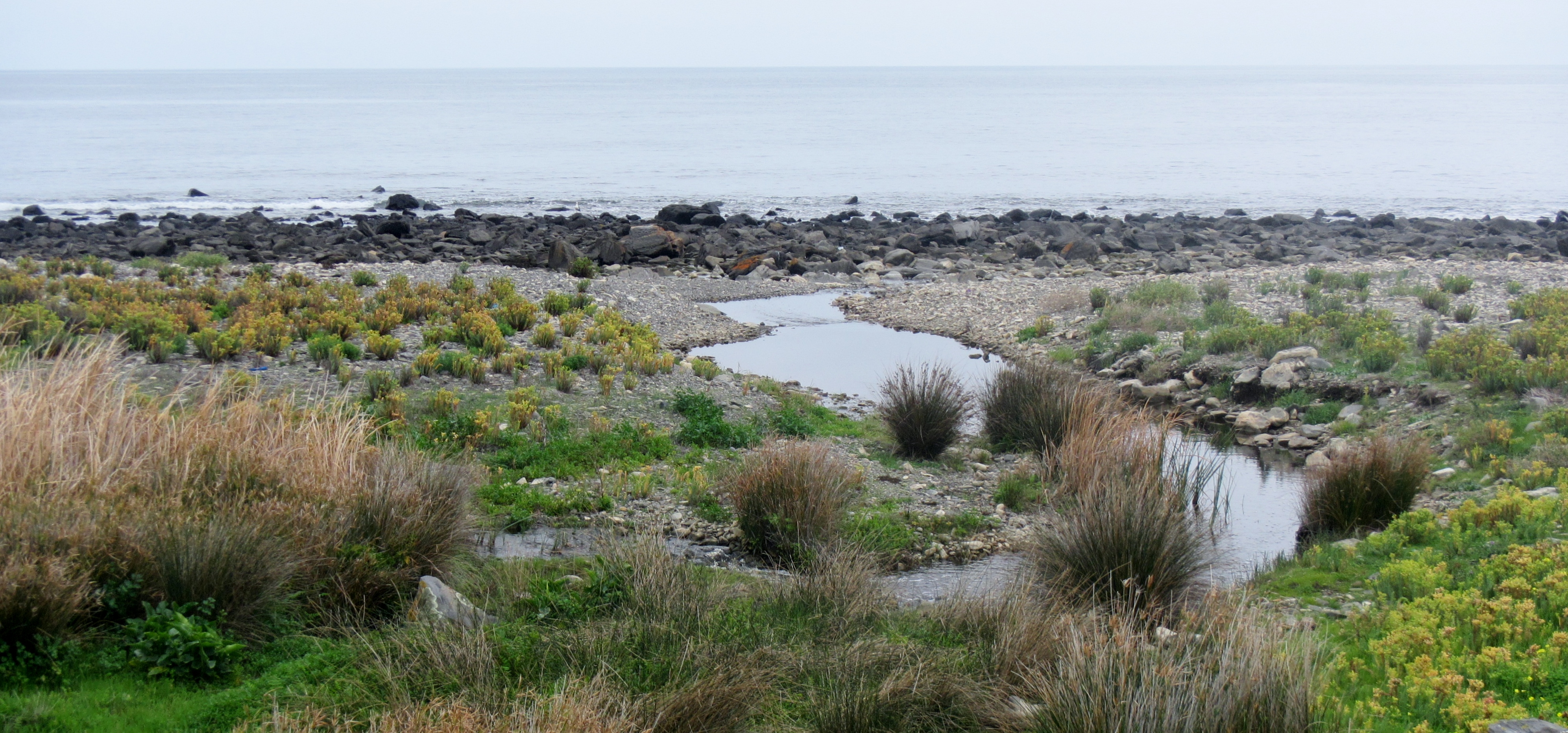
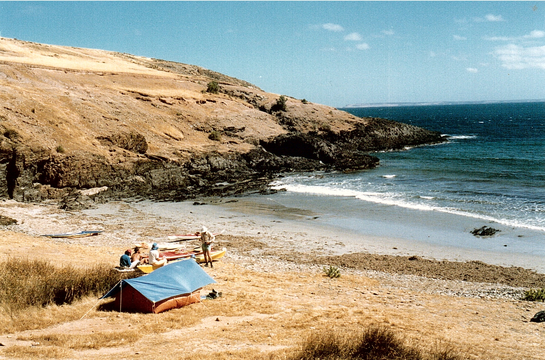
The camp was located inland a few hundred metres on the banks of the Chapman River, however on such a low tide the mouth was closed and a portage was required.

Landed on Antechamber Beach


Paddling up the Chapman River


View along the river

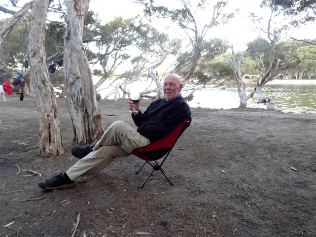
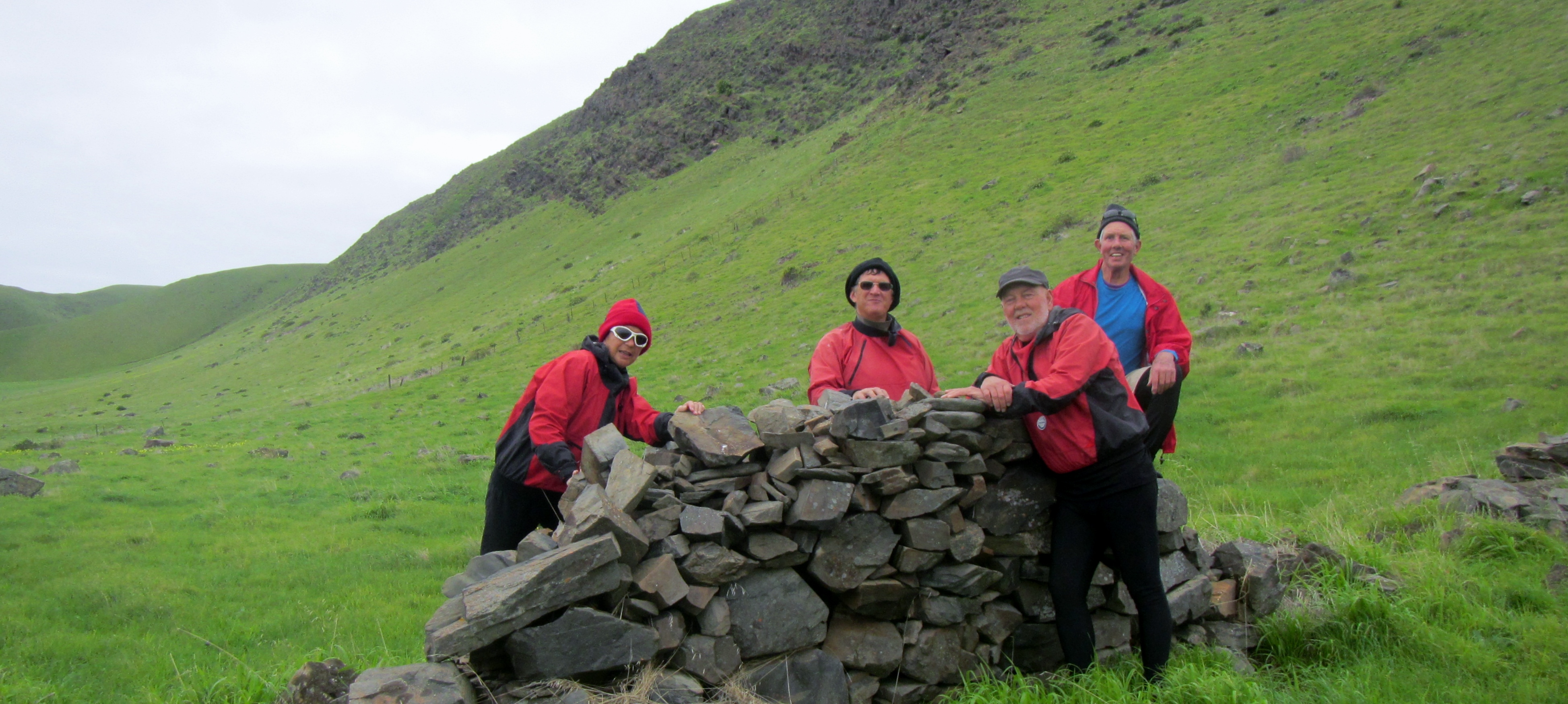
This riverside campsite went perfectly with a Grant Burge Shiraz, kindly supplied by Rodney, our personal sommelier.

Early evening drinks and snacks

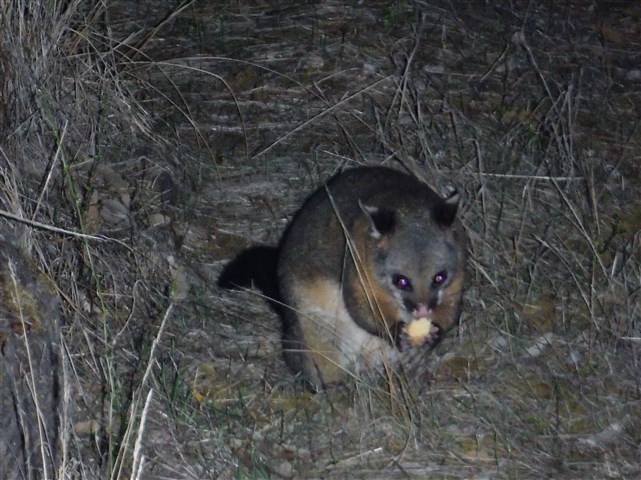
I did tell Rodney the Possums were very friendly but he was still a little amazed to find one sitting at the table with him. This guy grabbed some food and ran.

This guy believes in self serve

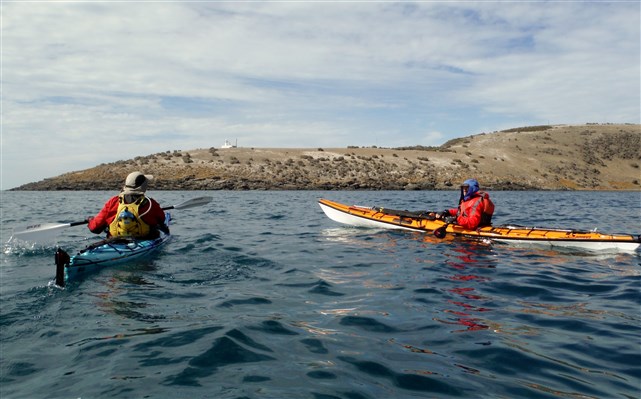
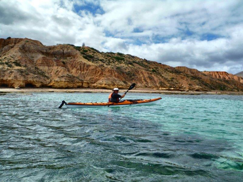
The next day was perfect weather with only a light 4kn breeze predicted and very little tidal movement. We set off to portage back into the ocean and head for the Scraper Reef and then to Cape Willoughby and Pink Bay .

Members of the South Australian Boat Draggers Association in action.

The boat draggers


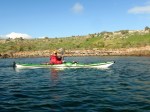
Heading out of Antechamber Bay

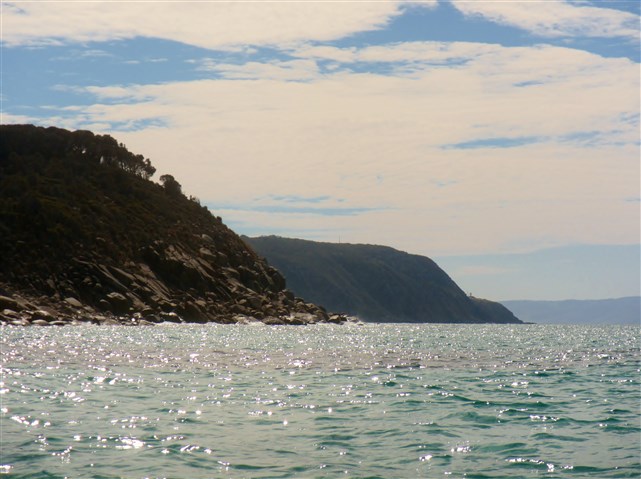
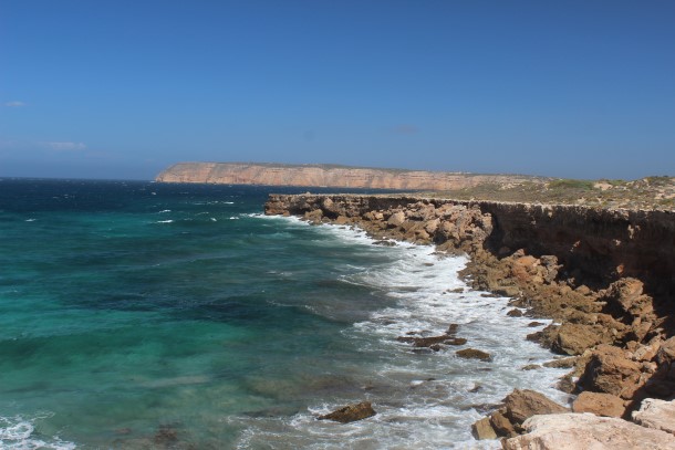
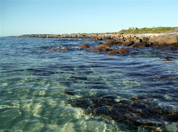
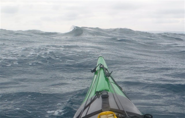
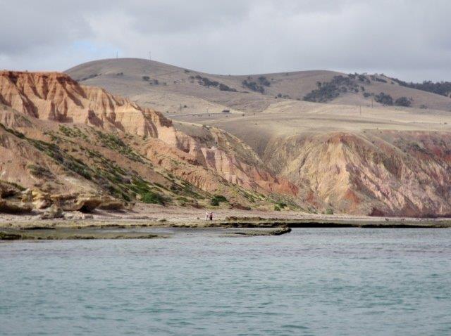
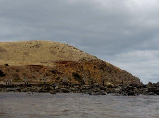
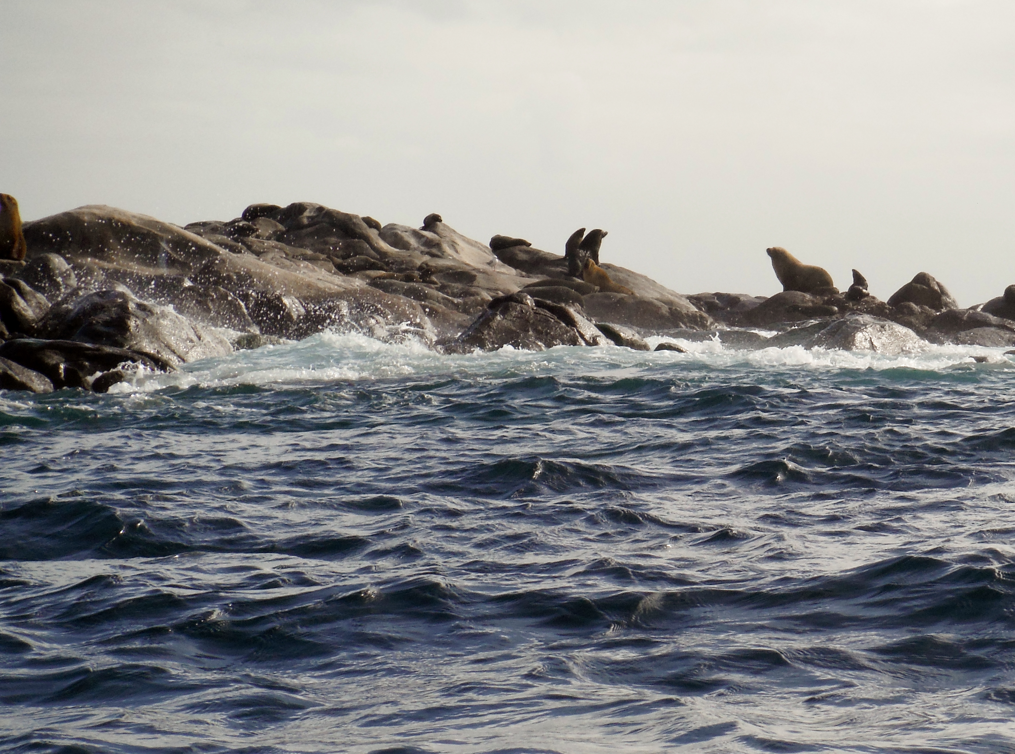
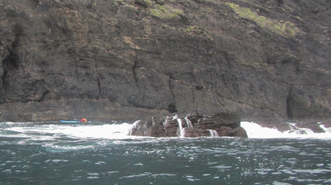
The Scraper lays approx. 1km off Cape St Albans and is well known for its’ large breaking waves in any easterly weather. Water over the reef is only 1 fathom deep (about 3.3ft/ 1.82m) taken on an average tide.

Unfortunately “Google Earth” doesn’t show “The Scaper” but you can get an idea of the wave action nearby if you view Cape St Albans photographs.

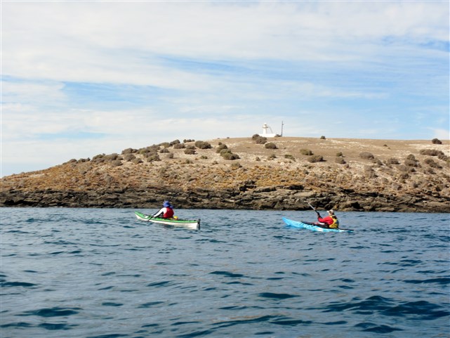
As we rounded Cape St Albans we caught a glimpse of large breaking waves but they were mainly slow moving swells across the reef.

Cape St Albans Lighthouse


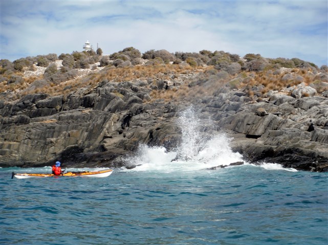
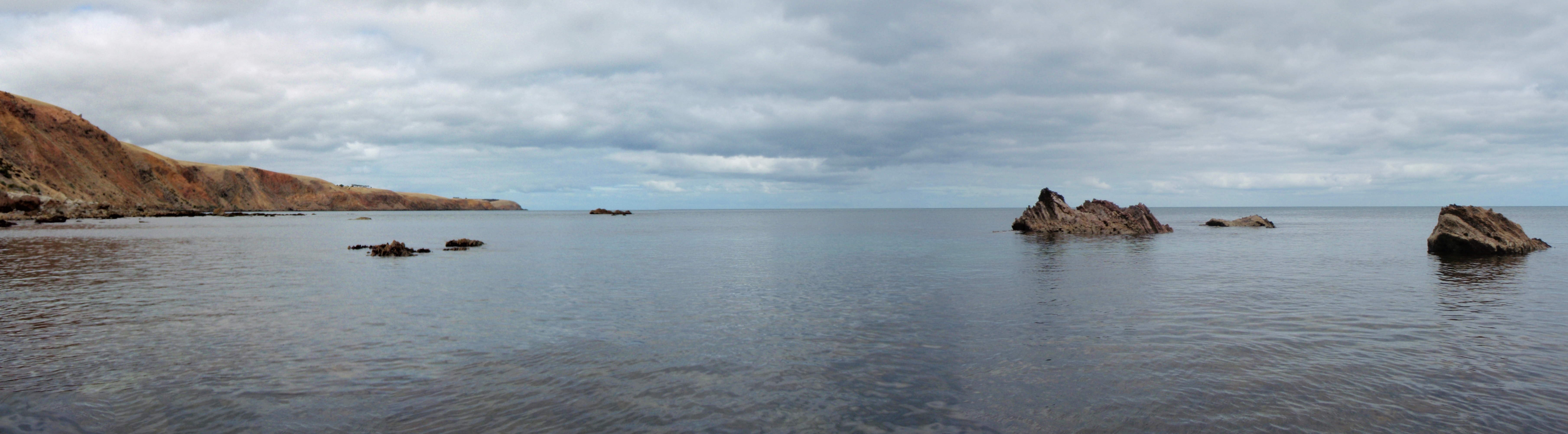
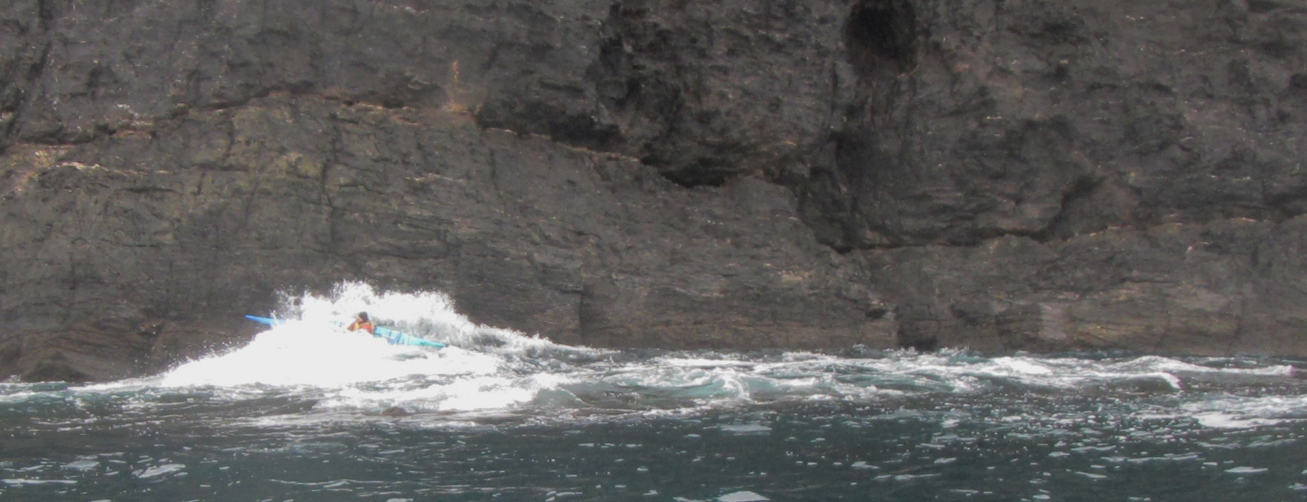
Arriving at the Scraper on slack water with the calmest conditions I have ever seen here

I paddled into the edge of the reef while Rodney took photos and Michael stood by as our safety paddler.

Riding a “Scraper” swell

We then pushed on towards Cape Willoughby.

Cape Willougby Lighthouse in the distance

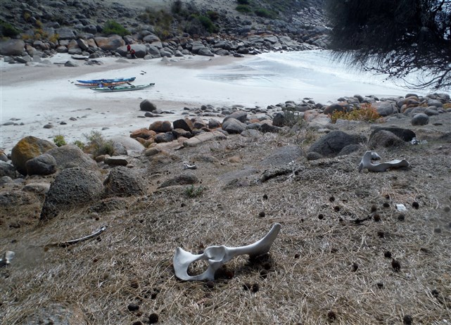
….. and landed at nearby Pink Bay.

A calm cove for lunch

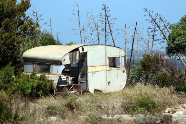
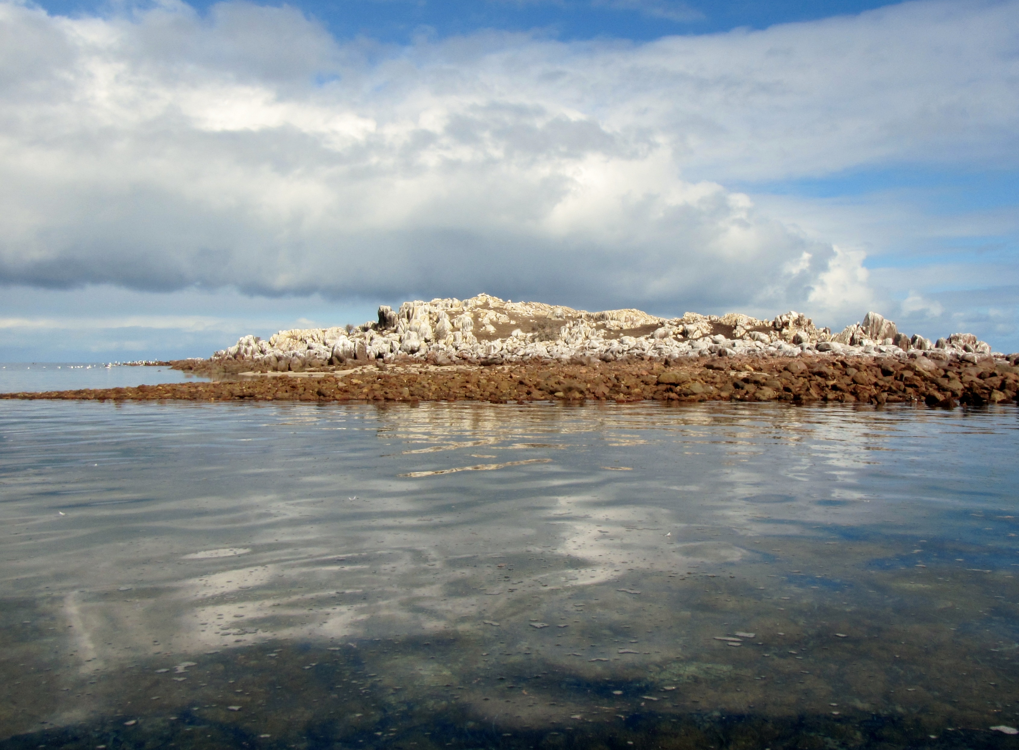
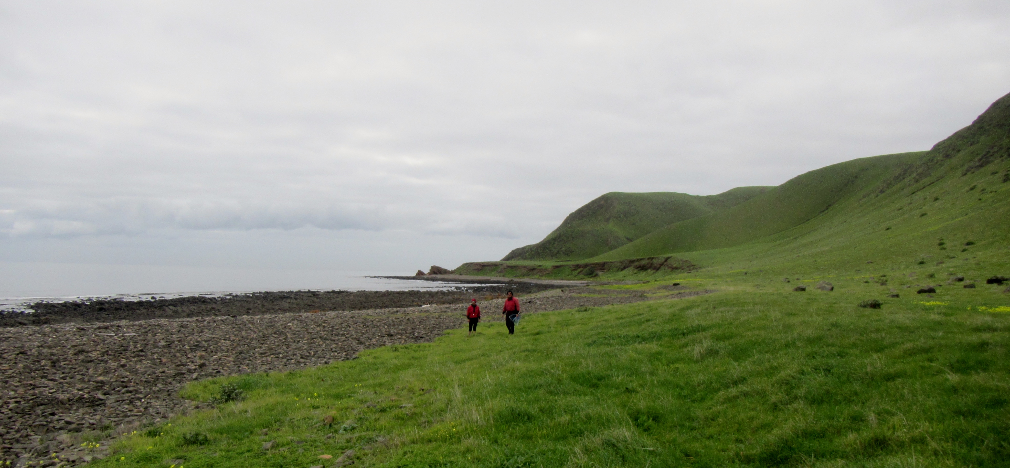
You can see the remains of previous inhabitants.

Evidence of habitation

After a lunch stop it was back on the water to catch a small flood tide back to camp.

Heading north from Cape Willoughby Lighthouse

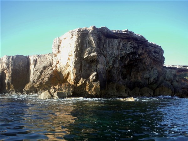
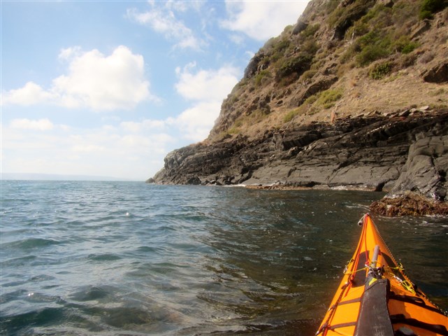
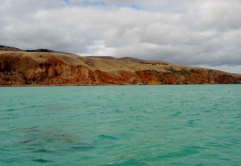
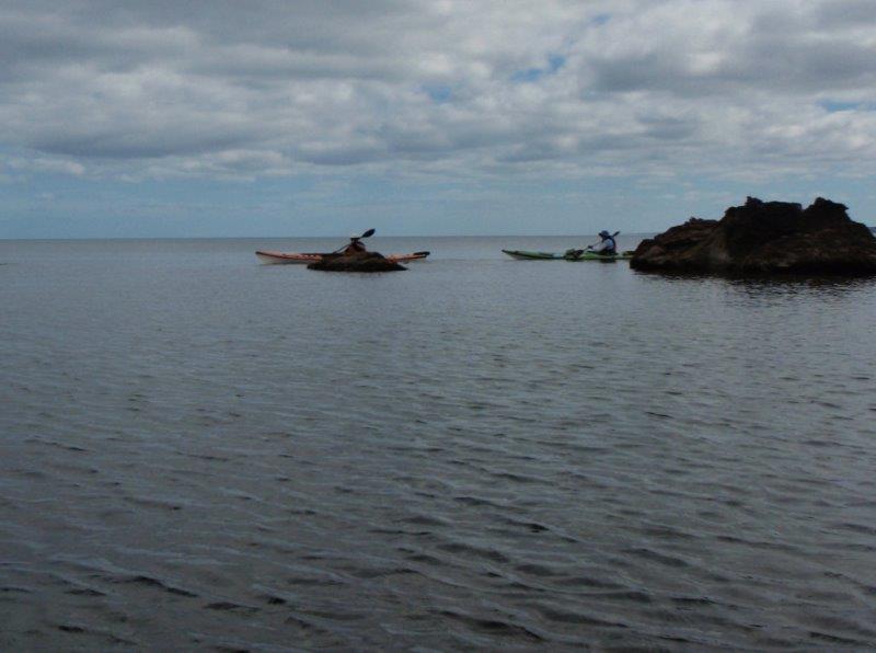
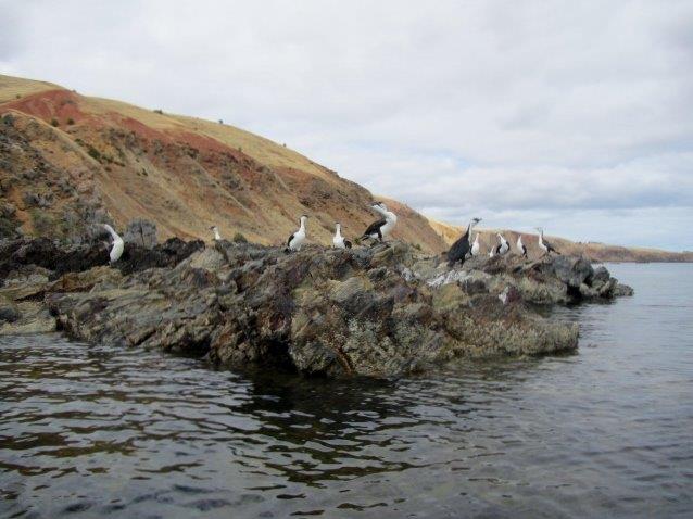
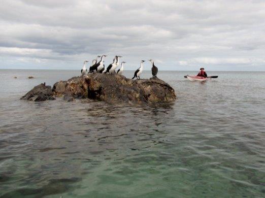
On the way we spent time playing in the rocks around Cape St Albans.

Floating along the cliff face


Floating around the rocks at Cape St Albans

Day 3
Light rain had fallen during the night and the wind was evident even in our protected campsite.

Light rain all night


Checking the weather from a warm place

We checked weather forecasts through a couple of sources which both predicted an acceptable wind from the SE. We had a phone conversation and ascertained that the wind at nearby Penneshaw was currently 11kn from the SE and it was expected to remain that way for a few hours.

We decided to cross earlier than planned as the last hour of the very small ebb tide would be overridden by the SE wind. We would then be running a flood tide with the wind in the same direction.

We packed and portaged back into Antechamber bay where conditions were as expected, being at the bottom of Beaufort Wind Scale around 4, meaning “smaller waves, becoming larger; numerous whitecaps”.  Our heading would take us within 1 nautical mile of the Yatala Shoals so I knew from experience that the waves would be quite steep and confused where the tidal rips collide.

We started off across the passage with the conditions as predicted.

Goodbye to Antechamer Bay

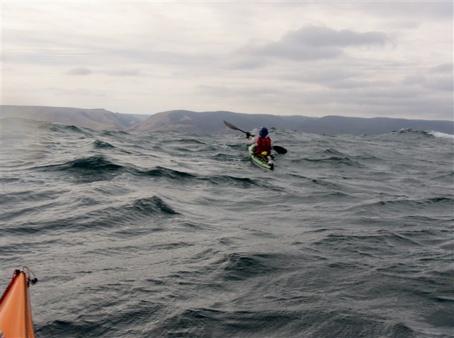
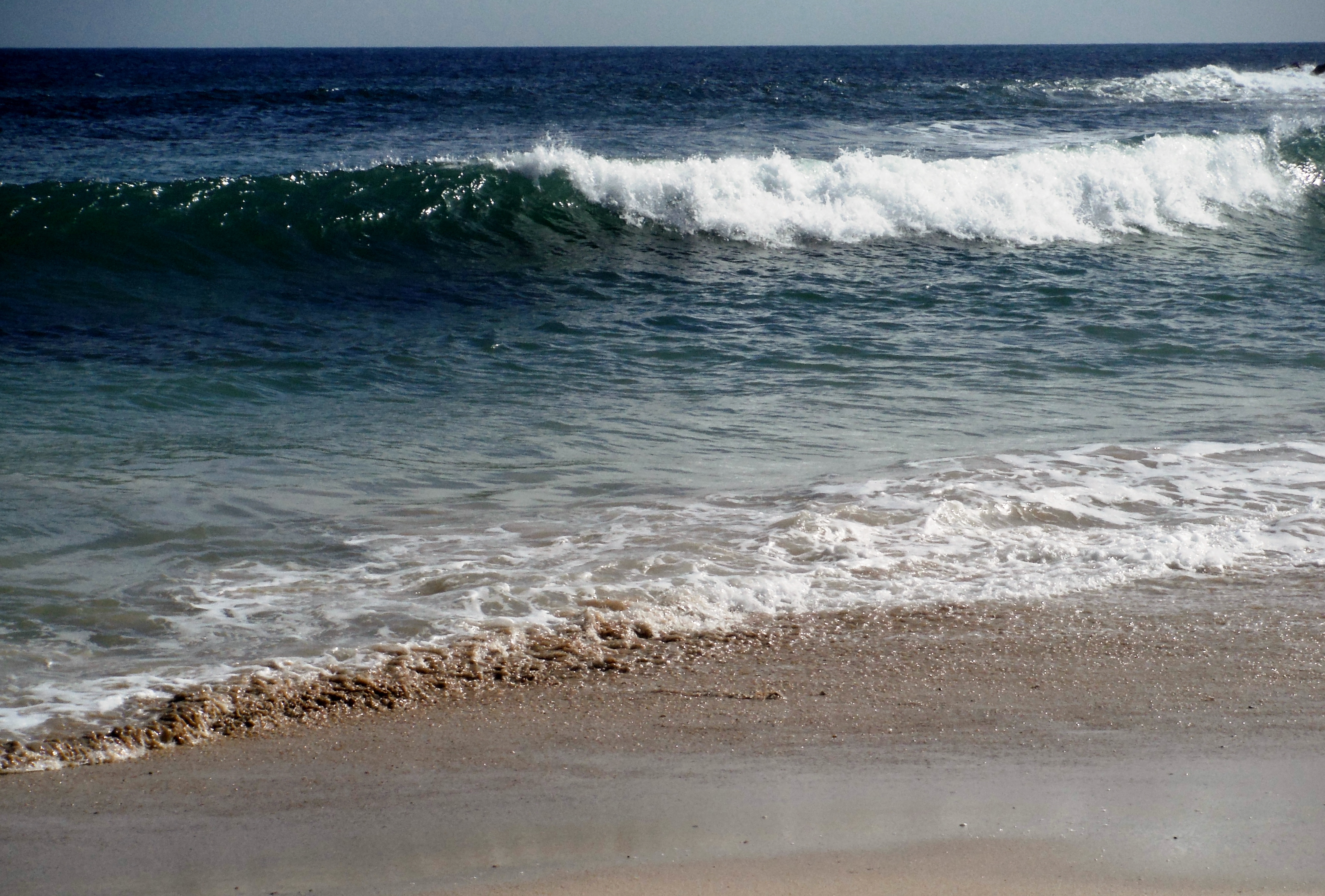
After 1 hr we found the SE wind had picked up slightly making for sloppy conditions with larger swells and occasional breaking seas. It was actually lots of fun making fast runs down steep waves and then being surrounded in deep troughs.

Michael and I were enjoying the conditions and Rodney was really getting the hang of running parallel to the waves, rising and falling as they swept under him.

Rodney having a fun day out


Michael was there one second and buried in water the next


Keeping on track

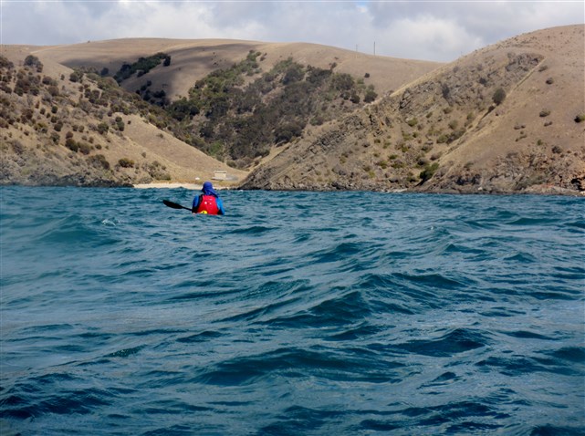
Everything continued to plan as we approached Blowhole Creek on the mainland and then started our run west to Cape Jervis staying a couple of kilometres offshore to get the best of the following sea.

Heading for Blowhole Creek (the gap in the hills)


Resting before the run into Cape Jervis

We arrived at Cape Jervis 4 hours after launching, with the crossing of Backstairs Passage from Antechamber Bay to Blowhole Creek taking around 2hr 30m.

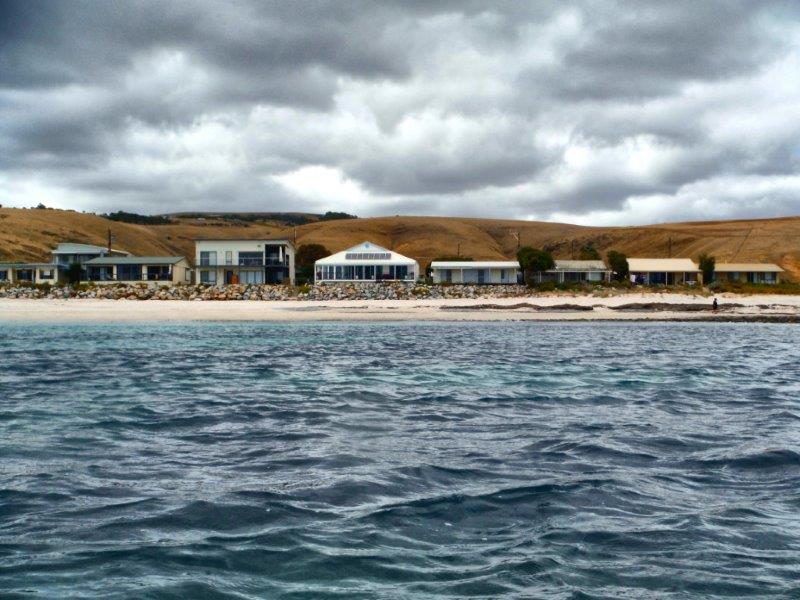
Our last duty to load up and head for the Yankalilla Bakery, for a decent cappuccino and pasty.

DSCF5355


Paddlers and photographs by Ian, Michael and Rodney. Editing by Ian.

pope2Yogi bearSir Rodney


Maippunga. Place of high cliffs.

It was some time after dawn and I could hear the wind whistling through the trees. I stuck my head out to feel a good 20 knots of wind which was supposed to have abated by dawn giving us a nice 10 knot SE breeze. Well that was the forecast anyway, but maybe things would calm down as the morning went on and the sun warmed to the predicted 25C.

Gavin and Rodney arrived with the wind dropping and our paddle to Maippunga Beach was on. The 16 km return trip is mainly along cliffs fronted by a narrow rocky  beach and is a lovely paddle in most conditions. Beware of anything over 15 knots from the SW which will give a short confused sea and testing paddling conditions, but today was not that day.

The wind had abated and close inshore is protected from the SE’ly winds by the high cliffs, so we were assured of a easy paddle at least until the predicted 20 knot southerly winds arrived later in the morning; hopefully providing a little fun on the way home.

The sky was mainly overcast with the sun poking through occasionally to light up the cliffs and give us the chance of a few nice photos. The water along this coast is often very clear and takes on an interesting blue colour as the light changes.

Looking south from Sellicks Beach

Looking south from Sellicks Beach

Calm seas

Calm seas

Maippunga is the Kaurna aboriginal name for the Myponga area and translates to “place of high cliffs”. The Kaurna people lived on this land before white settlement in the area about 1840. Before settlement the hills were covered with gum and wattle trees however large tracts were cleared by the first farmers in the area.

Our start on Sellicks Beach is at the outer limit of the Adelaide metropolitan area and was a place that I had spent holiday time as a child, although then it was just a few houses above the beach. Myponga Beach is a small beach area with a few holiday houses dotted along the shore and surrounding hills and has now become a premium place to have a holiday shack.

We paddled past a couple of dog walkers on the beach.

Beautiful morning for a walk

Beautiful morning for a walk

View along the coastline

View along the coastline

Clear water and limestone cliffs

Clear water and limestone cliffs


Gavin admiring the morning view

Gavin admiring the morning view

We were able to get in close among the rocks and check out the rock strata. Most of the area is sedimentary rock, formed from layers of sand, mud and limestone deposited on an ancient sea floor between, roughly, 1000 million and 600 million years ago. Geologists know this era as the Proterozoic era, meaning ‘first life’and until very late in the Proterozoic, the only life in the seas was blue-green algae, still familiar to us today.  The youngest rocks in the area belong to the Cambrian period (600 to 500 million years ago) when then-abundant marine animals evolved hard shells and thus began to show up in the fossil record. Fossils from Myponga Beach  were the first proof of Cambrian-age rocks in the greater Adelaide area.

Paddling amongst the rocky outcrops

Paddling amongst the rocky outcrops


Heading in for a closer look

Heading in for a closer look

DSCF5222


Eroded cliff face

Eroded cliff face

Finding a new path

Finding a new path

IMG_0932

We met some of the local inhabitants. There are rookeries of Pied Cormorants along the coast with numbers varying with the seasons. Pods of dolphins are also common offshore and there has been occasional sightings of Southern Right Whales in winter.

Pied Cormorants

Pied Cormorants

Meet the locals

Meet the locals


Stranded like a Shag on a rock

Stranded like a Shag on a rock

Myponga has a boat ramp for launching small fishing craft at high tide as long as you own a tractor and is now a favourite spot for a holiday house for those that can afford it.

Houses on Myponga Beach

Houses on Myponga Beach

Near the southern headland is the ruins of the old jetty which serviced a healthy shipping trade for 30 years exporting local wattle bark for leather tanning, livestock and wheat. The jetty opened in tragic circumstances when a woman nursing a baby fell off onto the rocks. She cushioned the fall of the baby which survived, but unfortunately she was killed. Eventually the ketch trade weaned and a big blow tore the jetty apart in 1900.

Remains of the old jetty

Remains of the old jetty

On our return trip we headed a kilometre or more offshore to pick up the predicted southerly wind. This is a great easy sea kayak paddle in the right conditions, but can be a very difficult paddle when the SW winds blow causing a confused sea, clapatis close inshore and is often affected by catabatic winds along the cliffs.

Photos by Gavin  Rodney and Ian.

Hagar pope2 Sir Rodney

The Western Shore

The Aagot, an iron Barque of 1242 tons, built at Glasgow, 1882, as the Firth Of Clyde, but now laying on rocks on Wardang Island. A gale on 11 October 1907. wrecked the ship in rough seas and  imprisoned the crew on board until the ebb tide moderated conditions and allowed a member of the crew to swim ashore with line. wreck_aagot I’ve paddled past the wreck site a number of times in fair weather and seen the outline of the anchor poking from the rocks at low tide but this time we looked at the wreck from a different angle. We had paddled offshore 13km from Pt Victoria to the north western side of Wardang group of islands with a fresh headwind and short chop. This route is quite shallow and reefy in places and always makes for interesting wave action when the wind is up. We camped the night waiting for a better weather window, but it seemed to disappear, being replaced with a stiff headwind and SW swell. IMG_9904 Our journey down the western side of the island started well enough with a 10-12kn headwind and  sloppy sea but within 2 kilometres of the wreck site it had shifted up a gear to 12-17kn with larger swells and a breaking sea on top. Wardang Goose Is 122Not ideal conditions for kayak photography so we decided to land at one of the small protected beaches and check out the wreck site from the land. Of course there was a savage shore break which proved to be a little fun, especially for Robyn and Ian in the Seaward Passat double kayak. Rodney fared better with a text book landing on the sand. Wardang Goose Is 177

Wardang Goose Is 187 Few people visit this uninhabited island group and generally you will only encounter the occasional fishing boat. Wardang Goose Is 171 We however found numerous tracks of the local inhabitants. Wardang Goose Is 134 A walk over the rocky headland bought us to the wreck site and we could see that in a gale this coast would have been treacherous. Not surprisingly there are many ship wrecks on this coast as it is a low island group that can easily meld in with the mainland when viewed from sea. The island also didn’t have any navigation light until 1909 and even then various maps showed it in different places just to cause a little more confusion. This few kilometers of coastline has the remains of the ships, Aagot, Australian, Investigator, Notre Dame D ‘Arvor, Monarch and McIntyre.

The Aagot anchors lay below these waves.

Wardang Goose Is 159 One strange thing about  beach combing the area was an abundance of right foot thongs washed up. Only right foot…never the left….what a strange phenomenon.

IMG_0656
Our time exploring was cut short as the wind threatened to further increase off shore. We made a perfect departure from the protected beach timing our breakout perfectly to avoid the shore break. The run back to camp was fast and furious sliding down a following sea and occasional breaking waves to arrive at the protection of the north tip of the islands. The north tip is home to a colony of Sea Lions and a large number of Pied Cormorants who inhabit the rocky outcrops so it was relaxing to hide in the lee and enjoy the antics of the locals.


Wardang Goose Is 226 Wardang Goose Is 209 Wardang Goose Is 197 We had left our campsite guarded by a Peregrine Falcon who had taken up residence in an old radio tower. IMG_9922 We landed back at camp having had an interesting paddle and looking forward to the evening meal with celebratory red wine. Rodney had chosen an excellent Grant Burge Balthasar 2012 Shiraz and Grant Burge 2010 Corryton Cabernet Sauvignon and Robyn and I provided a lovely Eccolo Wines Sangiovese. The wines  and pre-dinner snacks were enjoyed with great gusto watching the sun set and the full moon rise. Wardang Goose Is 292 Next day we headed along the eastern coast of Wardang Island with thoughts of the Narungga people who had been travelling to Wardang Island long before the arrival of Europeans. The island could be accessed at low tide by wading out to Green Island and then swimming for  kilometres across a deep channel. People would sit on the shore and sing songs and wave branches to distract the sharks from swimmers. I started singing quite loudly when a fin appeared of the stern of the kayak but luckily it was only a dolphin.

Mining of Lime Sand had begun on the island in 1910 and lasted for several years until easier  to access deposits were located. There are still remnants of the small community that was involved in mining and agriculture. The island was once stocked with sheep and large water tanks were constructed, living quarters, shearing sheds and other facilities were built. Several families stayed on the island to manage the stock and the children attended a small school. A barge was used to ferry materials and stock to and from the island and later a ketch, ‘the Narungga’, would move between the island and Dolly’s wharf. IMG_9908 The ketch “Narrunga”, shown here tied up at Dollys Wharf. narnarungga Little remains of Dollys Wharf these days. Wardang Goose Is 037 The last part of the paddle brought a few light rain showers indispersed with periods of bright sunshine and light winds. A fitting end to another great paddle. IMG_0711   …and a few extra photos from our trip.


Thanks to Rodney for the photos, delicious snacks interesting wine and of course to Robyn for all other catering.

Ian, Robyn and Rodney. Paddling South …..where not everything goes to plan

The mysteries of Yoho beach

It happens every year. Somewhere between Friday the 13th and the Winter Solstice on 21st June we watch the weather patterns for the perfect day that will take us back to Yoho Beach. That type of day where the sky is just a  haze, sea the colour of ink and the horizon almost indistinguishable, is when we return to continue our research on Yoho Beach.

During summer we often paddle past Yoho beach, which lies in Gulf St Vincent just a few kilometers north of the gulf’s entrance at Cape Jervis. It’s a lovely place to paddle on a warm summer day, passing along the rock strewn coastline, looking at the abundant bird life and keeping an eye out for the local dolphin pods but the swells are rarely low enough to land. But in winter at the appointed time we return to continue our study of the mysteries of Yoho Beach.

We set off from Rapid Bay for the hop along the coastline passing the towering cliffs of Rapid Heads and enjoying the frolicking seals. The water is calm, dark and certainly deep as we round the headlands.

IMG_0555


IMG_0563


IMG_0573


IMG_0601

IMG_0604

Paddling along this area is always eventful, especially when you get in close to the cliffs and ride the surging waves as Michael soon found out.

IMG_0606

IMG_0607

After a while the Headlands of Yoho come into view, with the winter grasses blanketing the slopes.

IMG_0574

It’s an odd place, sort of eerie, a strangeness that creeps up on you every time you land there. You always feel like you are being watched by someone lurking on those bald rock strewn hills; but there is never anyone there. Like someone is looking over your shoulder when you wander along “beach combing” the area, but I’ve never met anyone else on the beach and know of only a few people who ever stop there to explore or enjoy lunch on the grassy slopes.

This year we bought with us “Professor” Rodney B.,  a newcomer to this area, who could hopefully cast more light on the strangeness of Yoho.

We carefully landed in the small channel and came ashore.

IMG_0598

IMG_0583

An ancient rock wall stands guard halfway along the beach, it’s purpose long lost and the people who built it long departed.

IMG_0584

A small creek winds its’ way to the ocean making an excellent habitat for local fauna.

IMG_0591

The first sign that something was different here was what we found when beachcombing. Left foot thongs. Never a right, only a left. Some people call them Flip-Flops others Sandals but in Australia they can only be Thongs. Over the years we found some with Asian branding, some with English, a few with German and Arabic, some near new, others with the imprint of the previous owner well worn into them. All sizes, all shapes, all left foot they magically came to be washed up on this lonely beach.

A colourful thong


IMG_0578

We kept returning over the years to see more thongs as well as a scattering of other shoe styles, still all left foot, and recently we have been coming across more  left foot Crocs wedged amongst the rocks.

washed up amongst the seaweed

washed up amongst the seaweed

IMG_8832

Lost and lonely

We have even picked up a compass, it was probably discarded as it too pointed Left.

IMG_6983

Pointing left of North

We often gathered with a nice bottle of McLaren Vale Shiraz and wondered about this place. We pored over tidal flow charts looking for answers and even started taking measurements in the area. We erected markers next to rocks so that they could be measured each year.

IMG_0597

Over the years we found that they too were wearing more on the left side than the right. The wind is also strange here, no matter which direction you turn it always comes from your Left.

Is it the unusual dodge tides that frequent the gulf that allow only left footwear to come ashore and why not the right as well ?. Is it the high pressure cells that pass through over summer, rotating in an anticlockwise direction ?.  Is it a stranger phenomenon, something that we don’t understand about this lonely beach ?.

Recently I was sorting some old camera equipment and saw my old Minolta waterproof camera that I had used in the 1980’s and when I found it still had film I decided to have it processed. The pictures were of sea kayaking and camping  near that beach.

An early visit to the area. camped on a rocky beach near Yoho.

An early visit to the area. camped on a rocky beach near Yoho.

And then there it was.  Maybe the answer to the riddle of Yoho beach partly hidden in the trees.

The Spaceship perched above the nearby beach

The Spaceship perched above the nearby beach

Was it the arrival of the spaceship, perhaps spinning anti-clockwise that created that Left vortex that is still there today?. I’m not sure that we will really ever know the answer but it sure makes a good reason to paddle along the rugged coastline, stop for some beach-combing and maybe even lookout for that spaceship 🙂

Ian, Robyn, Michael and “Professor”Rodney B.
Paddlingsouth