
The sky had been clear blue all day and the forecast was for that to continue. We camped at the town of Beltana, a heritage town, in the northern Flinders Ranges of South Australia and settled back to watch the sunset light up the sky as a few clouds streaked across.

Our plan was to ride two roads that join Beltana to the Outback Highway, both of which are recommended for 4WD vehicles only. This would be out and back style rides unless we decided on using the highway and sealed road into Beltana to turn it into a loop ride.
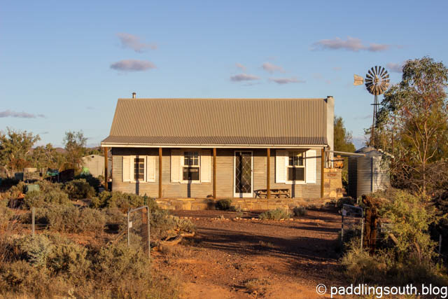
Beltana is a Heritage town with a small permanent population which increases slightly in the cooler winter months. New houses can be built in the town but they must comply with heritage style. The local hall displays an amazing art collection of Flinders Ranges landscapes with around 100 on display. It welcomes self sufficient campers such as us and it is well worth a walk or ride around the town.
Our first ride was on the Old Beltana Road which is a rocky, red dirt road that heads north for 20km, emerging through the Puttapa Gap, before joining the highway. Recently, Cyclone Ilsa pushed a rain band south from the tropics giving the area a good drink. We saw only a small amount of surface water in the creeks and the red clay roads were dry and hard.
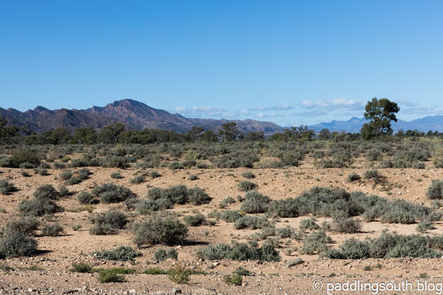
This is not an area to be taken lightly. Carry plenty of water and safety gear as few vehicles pass this way. It’s rocky, corrugated, washed out, sandy, bone shaking and stunning. Admiring the rock formations and the distant views as well as keeping the bike upright would be a challenge for anything other than a suspension mountain bike.

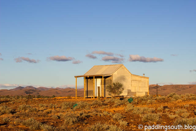
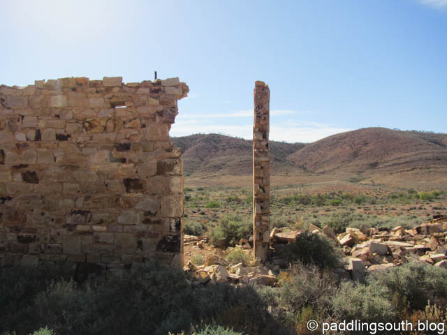
Following the Old Ghan Railway line and we came across ruins of the bridges and culverts as well as sidings that would have been flourishing 100 years ago.


I’m not sure what the name of this siding was but now it’s just a ruin with only partial walls still standing.
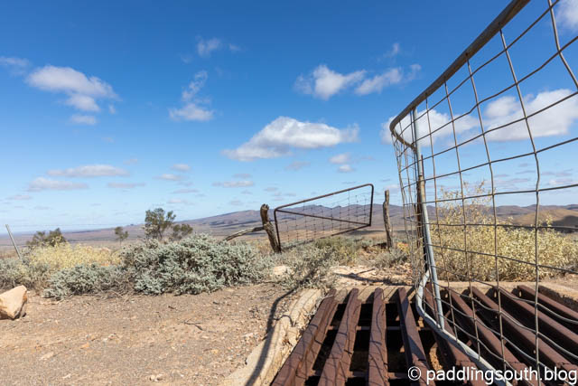
At the 20km mark we joined the Outback Highway and headed north for around 6km towards the town of Leigh Creek. Looking to your left you can see a communication tower high on a bluff and that was our destination. Again, don’t try riding this area when there has been rain. You won’t get far in the red clay. The turnoff is near a cattle grid on an unmarked track. Stop here and strap on a new set of climbing legs, or in our case shift the Ebike power up a notch. This is a long, rocky, rutted climb but with spectacular views from the top.
Beware of the gates, especially on the way down. It seems someone had a sudden stop.

It seems that mangled gates are a feature on this ascent.
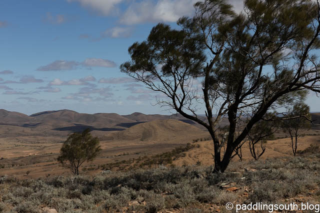
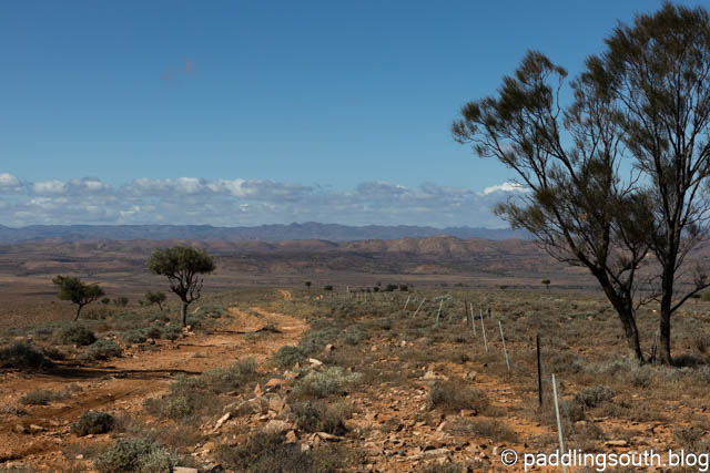
Sorry I didn’t get any photos until towards the top and they don’t do justice to the view. Still, I tried with these shots!

Now for the descent. Take it slow and easy going back down. You may be only a few kilometers out of Leigh Creek but few people pass this way and bike spares are impossible to find in this region. A blown tyre could mean a very long walk. Of course, I would disregard that advice and have a great time bombing down the track.
You can follow the red track in the photo to the lowest point in the valley, which is where you started the climb. The photo was taken about 1/3rd of the way down from the tower.
Now it’s only a matter of retracing your route to return to Beltana.
There are other “wildlife obstacles” to avoid along the track. Charging around a corner we surprised a herd of feral goats who dived in all directions. Luckily, they high tailed it up a steep embankment.

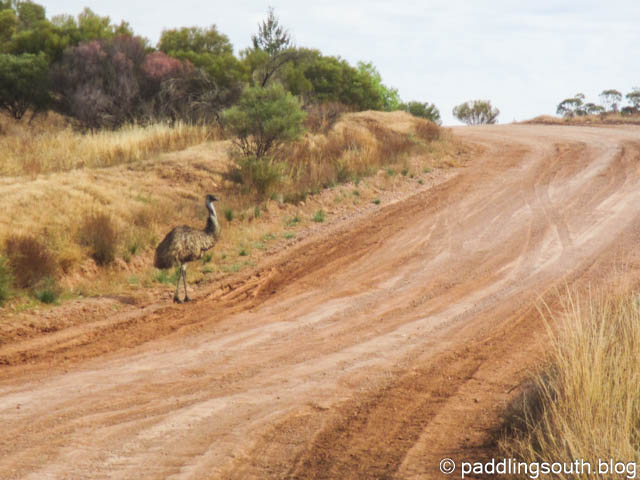
Emus are also numerous in this area. It’s not unusual to have a gaggle of Emus spear out from the bush and cross the road just in front of you. Nothing like seeing 200kg of flightless bird with long clawed legs, a sharp beak and beady eyes charging through the bush towards you.
The other wildlife encounter I had was with a female kangaroo with Joey in the pouch. She has bounding flat out along the track near me, with the Joey hanging out of the pouch screaming “faster Mum faster, we can beat this sucker”. No time for photos of that one; full power as I hate being beaten by kids.
We had previously tried to follow the Highway to Trebilcock Creek where maps showed a short cut to Beltana, but when we reached the turnoff the track was actually following a creek bed and strangely enough it had water in it. This gave us a less than enjoyable 20km on the Outback Highway and then 12km of sealed road to Beltana.
Back at camp the clear blue skies disappeared, and clouds gathered above us; and then it rained. The second 34km (return) ride on the southern 4WD track would have to wait.
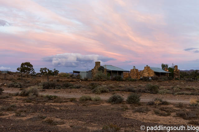
Beltana, a town with history. Robyn and I stood at the front of the hall, me knowing my father was here as he travelled north with the troop trains of WW2, and Robyn knowing her family lived and worked here on the overland telegraph over 100 years ago.
Beltana, a great place to visit in the cooler months and when it’s not raining!

